MyTopo
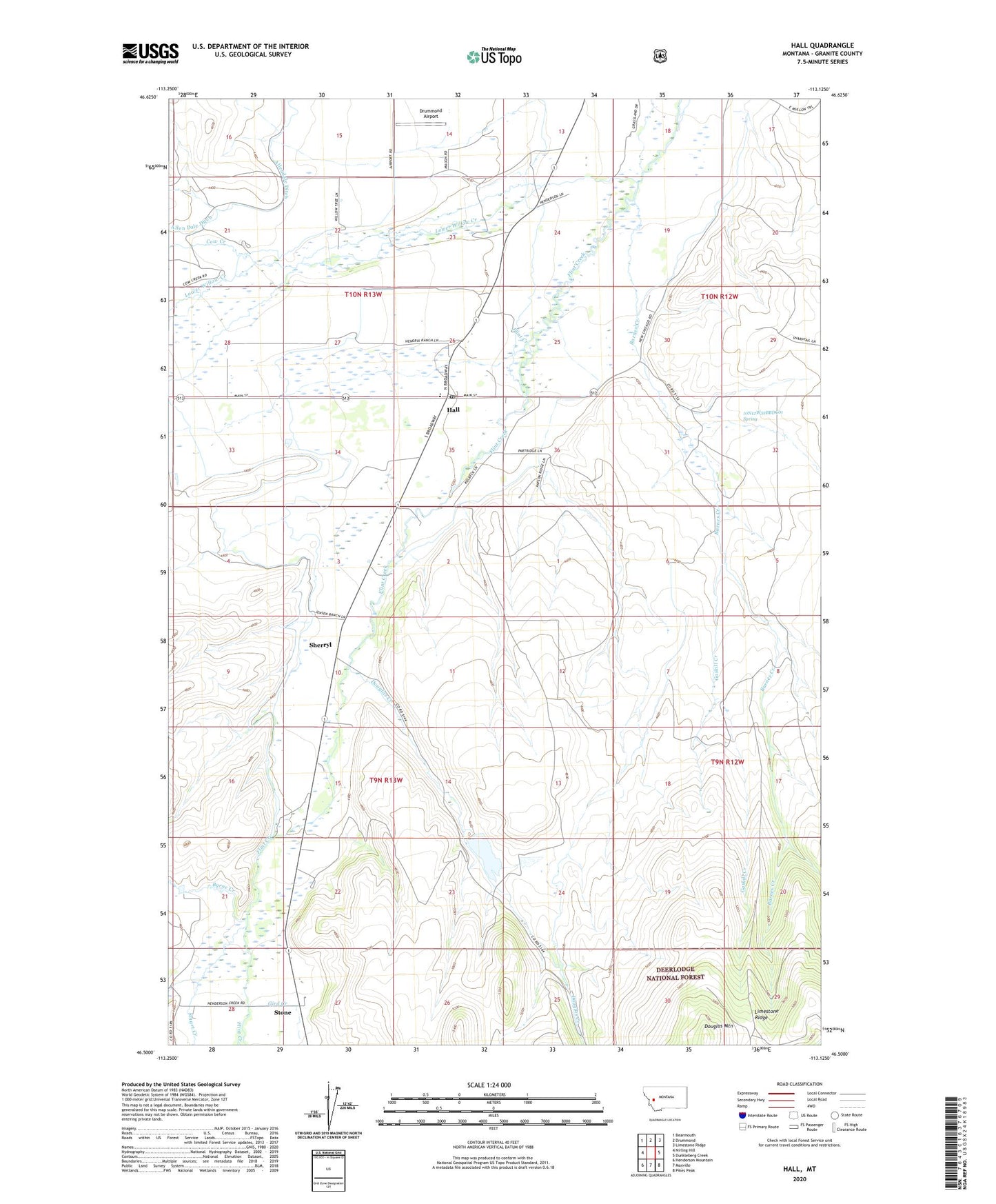
Hall Montana US Topo Map
Couldn't load pickup availability
Also explore the Hall Forest Service Topo of this same quad for updated USFS data
2024 topographic map quadrangle Hall in the state of Montana. Scale: 1:24000. Based on the newly updated USGS 7.5' US Topo map series, this map is in the following counties: Granite. The map contains contour data, water features, and other items you are used to seeing on USGS maps, but also has updated roads and other features. This is the next generation of topographic maps. Printed on high-quality waterproof paper with UV fade-resistant inks.
Quads adjacent to this one:
West: Nirling Hill
Northwest: Bearmouth
North: Drummond
Northeast: Limestone Ridge
East: Dunkleberg Creek
Southeast: Pikes Peak
South: Maxville
Southwest: Henderson Mountain
This map covers the same area as the classic USGS quad with code o46113e2.
Contains the following named places: 09N13W02CBBC01 Well, 09N13W10DCCC01 Well, 09N13W22BCDA01 Well, 09N13W27BCDD01 Well, 09N13W28CBAA01 Well, 10N12W30BABD01 Well, 10N12W31ACDA01 Well, 10N12W32BBDC01 Spring, 10N13W22AAAA01 Well, 10N13W22BDDA01 Well, 10N13W25CCCC01 Well, 10N13W26ABAA01 Well, 10N13W26DCCB01 Well, 10N13W29DDAA01 Well, 10N13W33CCBC01 Well, 10N13W34BBBB01 Well, 10N13W34DAAC01 Well, 10N13W36BABA01 Well, Allendale Ditch, Barnes Creek, Byrne Creek, Cow Creek, Douglas Creek, Drummond Airport, Elephant, Emmettsburg, Emmettsburg Post Office, Gaskill Creek, Gird Creek, Hall, Hall Census Designated Place, Hall Elementary School, Hall Post Office, Henderson Creek, Limestone Ridge, Lower Willow Creek, Placer Mine, Sherryl, Smart Creek, Southern Flint Creek Valley Historical Marker, Stone, Stone Post Office, Stone School, Wolling Wighter Dam