MyTopo
Lincoln Gulch Montana US Topo Map
Couldn't load pickup availability
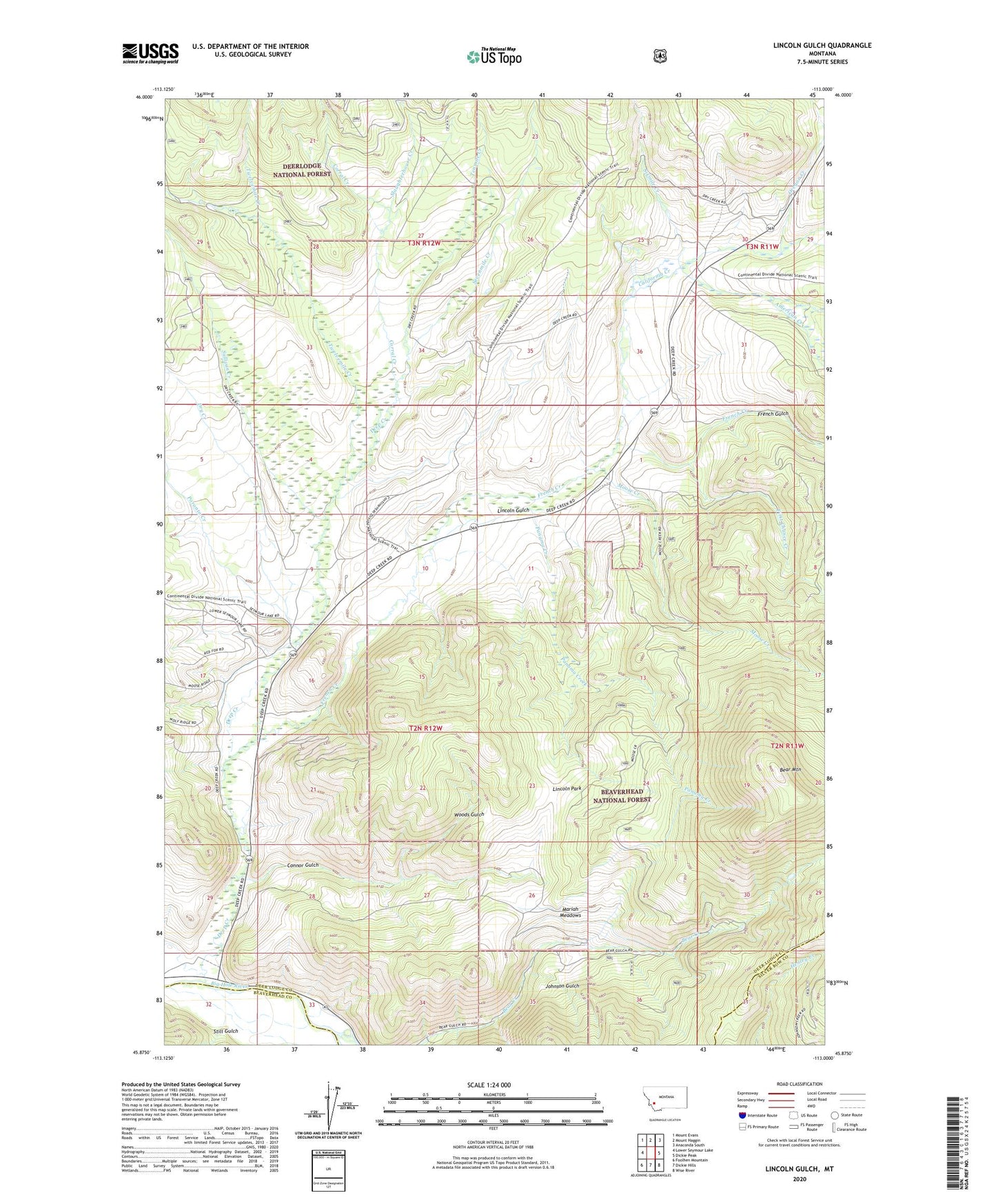
2020 topographic map quadrangle Lincoln Gulch in the state of Montana. Scale: 1:24000. Based on the newly updated USGS 7.5' US Topo map series, this map is in the following counties: Deer Lodge, Beaverhead, Silver Bow. The map contains contour data, water features, and other items you are used to seeing on USGS maps, but also has updated roads and other features. This is the next generation of topographic maps. Printed on high-quality waterproof paper with UV fade-resistant inks.
Quads adjacent to this one:
West: Lower Seymour Lake
Northwest: Mount Evans
North: Mount Haggin
Northeast: Anaconda South
East: Dickie Peak
Southeast: Wise River
South: Dickie Hills
Southwest: Foolhen Mountain
Contains the following named places: American Creek, Bear Mountain, California Creek, Connor Gulch, Corral Creek, Deep Creek, Deep Creek Ski Area, Dry Creek, First Chance Creek, Forest Rose Mine, French Creek, French Gulch, French Gulch Post Office, Furgeson Ranch, Home Ranch, Johnson Gulch, Johnson Ranch, Lincoln Gulch, Lincoln Park, Little American Creek, Little California Creek, Mariah Meadows, Moose Creek, Mule Ranch, Oregon Creek, Panama Creek, Poronto Creek, Ralston, Ralston Post Office, Ralston Ranch, Ralston School, Rousch Ranch, Sevenmile Creek, Sixmile Creek, Slaughterhouse Creek, Still Gulch, Sullivan Creek, Tenmile Creek, Twelvemile Creek, West Fork Twelvemile Creek, Woods Gulch