MyTopo
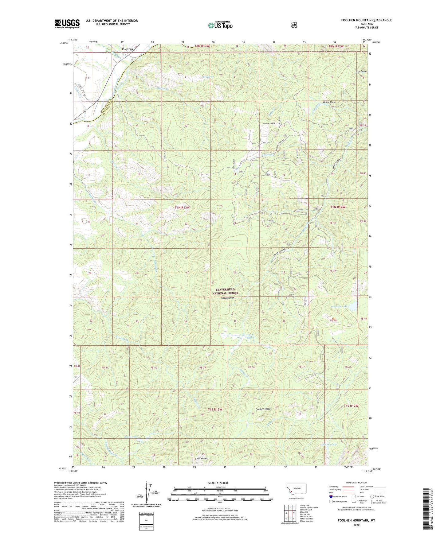
Foolhen Mountain Montana US Topo Map
Couldn't load pickup availability
Also explore the Foolhen Mountain Forest Service Topo of this same quad for updated USFS data
2024 topographic map quadrangle Foolhen Mountain in the state of Montana. Scale: 1:24000. Based on the newly updated USGS 7.5' US Topo map series, this map is in the following counties: Beaverhead, Deer Lodge. The map contains contour data, water features, and other items you are used to seeing on USGS maps, but also has updated roads and other features. This is the next generation of topographic maps. Printed on high-quality waterproof paper with UV fade-resistant inks.
Quads adjacent to this one:
West: Pine Hill
Northwest: Long Peak
North: Lower Seymour Lake
Northeast: Lincoln Gulch
East: Dickie Hills
Southeast: Stine Mountain
South: Shaw Mountain
Southwest: Proposal Rock
This map covers the same area as the classic USGS quad with code o45113g2.
Contains the following named places: 01N13W04BCBC01 Well, Calvert Creek, Calvert Hill, Calvert Mine, Ferguson Lake, Fishtrap, Fishtrap Campground, Fishtrap Creek, Fishtrap Creek Sportmans Access, Fishtrap Post Office, Fishtrap School, Foolhen Forest Service Statin, Foolhen Mountain, Foolhen Ranger Cabin, Foolhen Ridge, Johanna Lake, La Marche Creek, Lovell Lake, Minnie Creek, Moose Park, Trident Meadows, Trident Peak, Tucker Creek, Walker Creek, Zero Spring