MyTopo
Little Sheep Mountain Montana US Topo Map
Couldn't load pickup availability
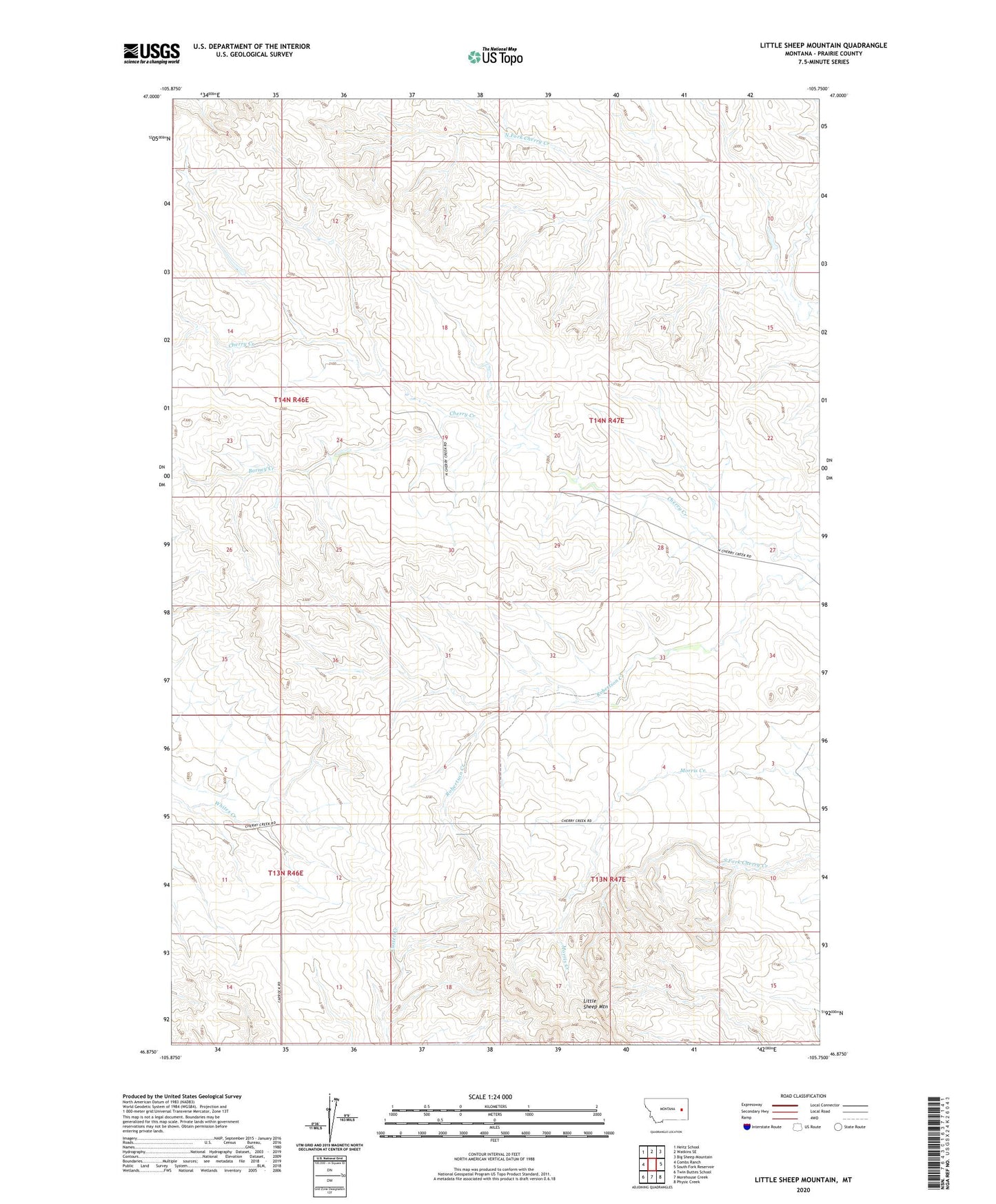
2020 topographic map quadrangle Little Sheep Mountain in the state of Montana. Scale: 1:24000. Based on the newly updated USGS 7.5' US Topo map series, this map is in the following counties: Prairie. The map contains contour data, water features, and other items you are used to seeing on USGS maps, but also has updated roads and other features. This is the next generation of topographic maps. Printed on high-quality waterproof paper with UV fade-resistant inks.
Quads adjacent to this one:
West: Combs Ranch
Northwest: Heitz School
North: Watkins SE
Northeast: Big Sheep Mountain
East: South Fork Reservoir
Southeast: Physic Creek
South: Morehouse Creek
Southwest: Twin Buttes School
Contains the following named places: 13N46E02DDCC01 Well, 13N46E12DCDD01 Well, 13N47E03CABB01 Well, 13N47E03CCDD01 Well, 13N47E06ACBA01 Well, 13N47E07ABBD01 Well, 13N47E15CABC01 Well, 14N46E13DBDC01 Well, 14N46E13DDDC01 Well, 14N46E36BCAB01 Well, 14N47E04ADCC01 Well, 14N47E05CCBA01 Well, 14N47E08BDDB01 Well, 14N47E08BDDC01 Well, 14N47E17AADB01 Well, 14N47E19CBBD01 Well, 14N47E20CBDB01 Well, 14N47E20DCCA01 Well, 14N47E20DCCB01 Well, 14N47E32CCBC01 Well, Barney Creek, De Grand Post Office, Devlin Ranch, Keltner Number 1 Dam, Little Sheep Mountain, McDevlin Number 2 Dam, Pershing School, South Fork School