MyTopo
Loco Ridge Montana US Topo Map
Couldn't load pickup availability
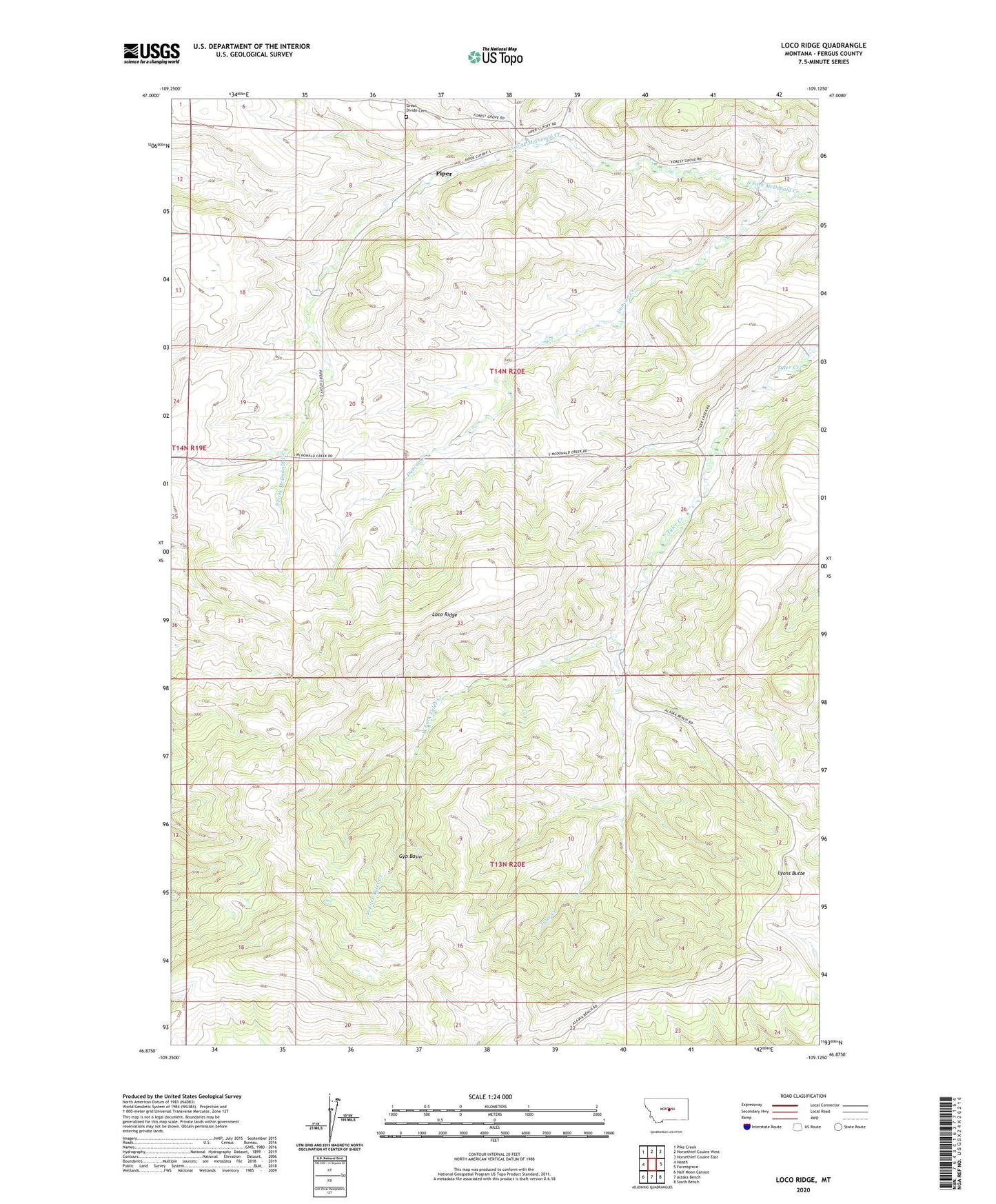
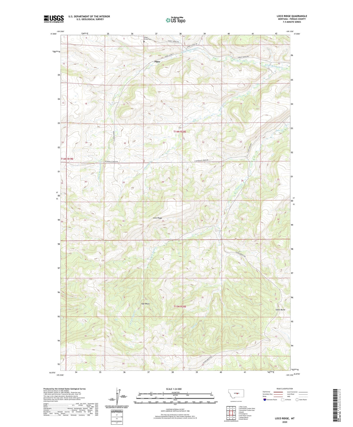
2020 topographic map quadrangle Loco Ridge in the state of Montana. Scale: 1:24000. Based on the newly updated USGS 7.5' US Topo map series, this map is in the following counties: Fergus. The map contains contour data, water features, and other items you are used to seeing on USGS maps, but also has updated roads and other features. This is the next generation of topographic maps. Printed on high-quality waterproof paper with UV fade-resistant inks.
Quads adjacent to this one:
West: Heath
Northwest: Pike Creek
North: Horsethief Coulee West
Northeast: Horsethief Coulee East
East: Forestgrove
Southeast: South Bench
South: Alaska Bench
Southwest: Half Moon Canyon
Contains the following named places: Duncan Creek, Duncan Creek School, Erickson School, Fishburn School, Great Divide Cemetery, Great Divide School, Gyp Basin, Jackman, Loco Ridge, Lyons Butte, Orange, Piper, Piper Post Office, West Fork Tyler Creek