MyTopo
Locomotive Butte Montana US Topo Map
Couldn't load pickup availability
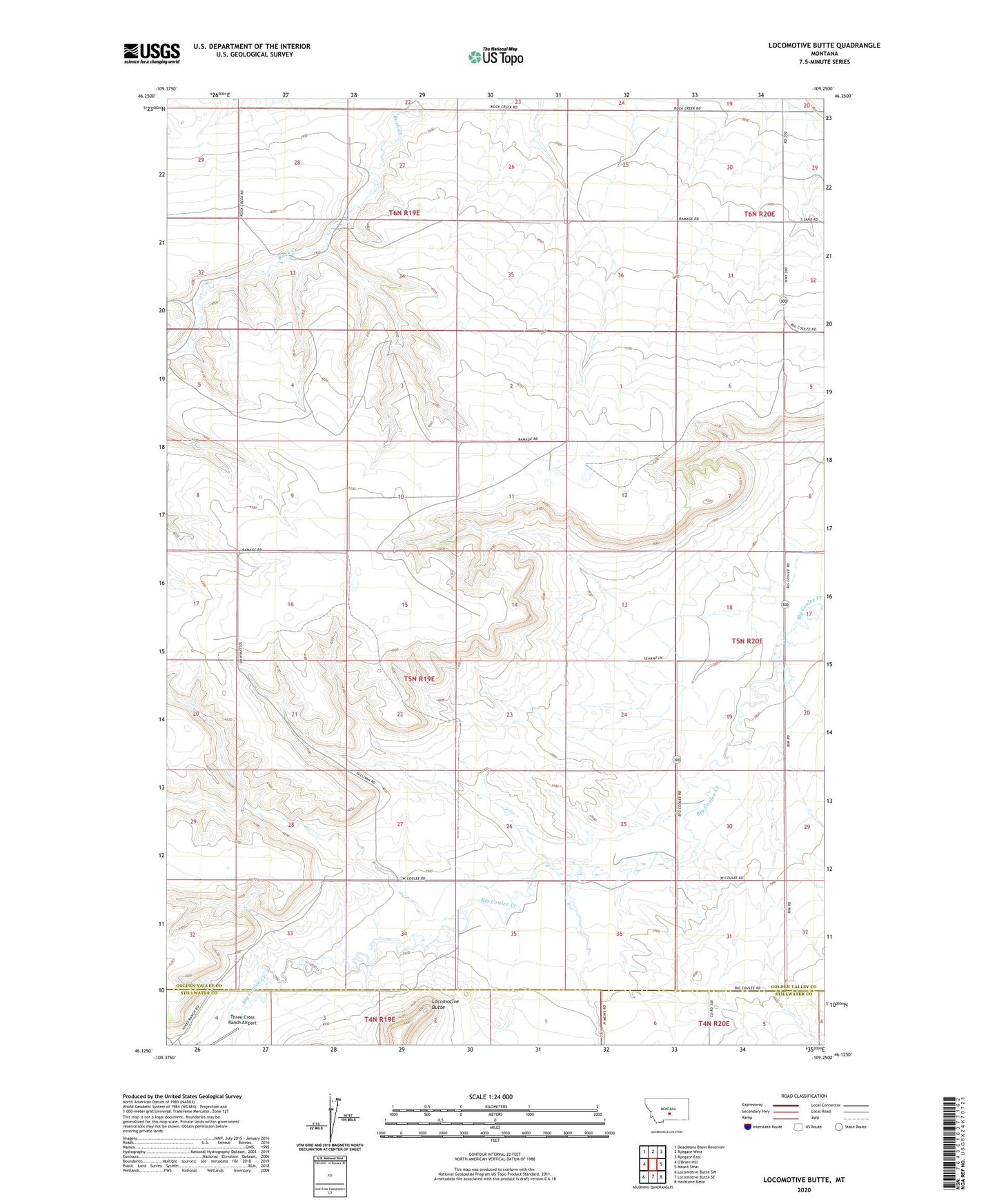
2024 topographic map quadrangle Locomotive Butte in the state of Montana. Scale: 1:24000. Based on the newly updated USGS 7.5' US Topo map series, this map is in the following counties: Golden Valley, Stillwater. The map contains contour data, water features, and other items you are used to seeing on USGS maps, but also has updated roads and other features. This is the next generation of topographic maps. Printed on high-quality waterproof paper with UV fade-resistant inks.
Quads adjacent to this one:
Northwest: Deadmans Basin Reservoir
North: Ryegate West
Northeast: Ryegate East
East: Mount Sinai
Southeast: Hailstone Basin
South: Locomotive Butte SE
Southwest: Locomotive Butte SW
This map covers the same area as the classic USGS quad with code o46109b3.
Contains the following named places: 05N19E25DDCA01 Well, 06N20E29BBCB01 Well, Hope Post Office, Locomotive Butte, Ryegate Division, Seventynine, Seventynine Post Office