MyTopo
Deadmans Basin Reservoir Montana US Topo Map
Couldn't load pickup availability
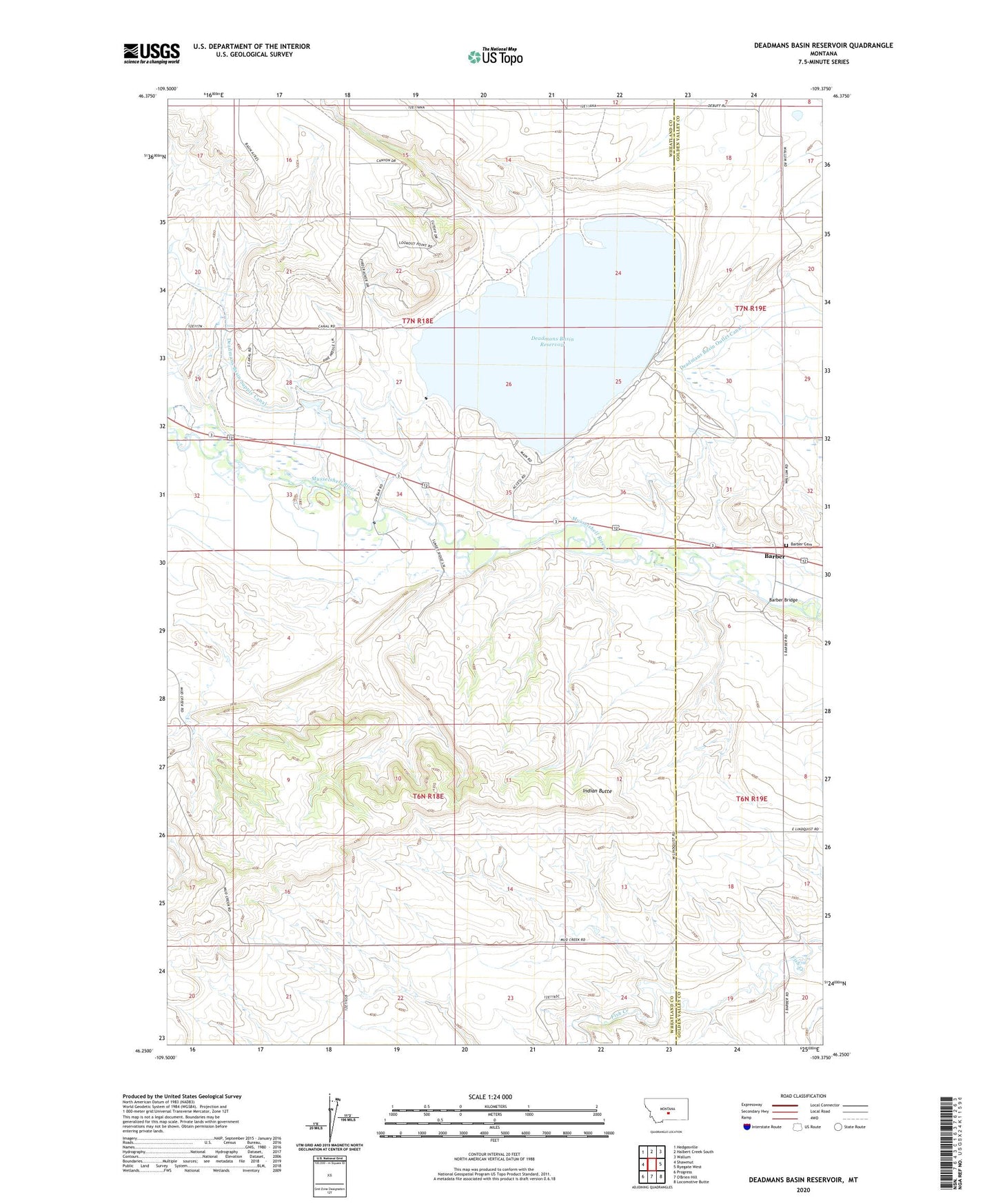
2024 topographic map quadrangle Deadmans Basin Reservoir in the state of Montana. Scale: 1:24000. Based on the newly updated USGS 7.5' US Topo map series, this map is in the following counties: Wheatland, Golden Valley. The map contains contour data, water features, and other items you are used to seeing on USGS maps, but also has updated roads and other features. This is the next generation of topographic maps. Printed on high-quality waterproof paper with UV fade-resistant inks.
Quads adjacent to this one:
West: Shawmut
Northwest: Hedgesville
North: Halbert Creek South
Northeast: Wallum
East: Ryegate West
Southeast: Locomotive Butte
Southwest: Progress
Contains the following named places: 06N18E15BBA_01 Well, 07N18E08DDC_01 Well, Barber, Barber Bridge, Barber Cemetery, Barber Post Office, Barber School, Deadmans Basin Campground, Deadmans Basin Dam, Deadmans Basin Fishing Access Site, Deadmans Basin Reservoir, Indian Butte, Mud Creek