MyTopo
Lone Indian Peak Montana US Topo Map
Couldn't load pickup availability
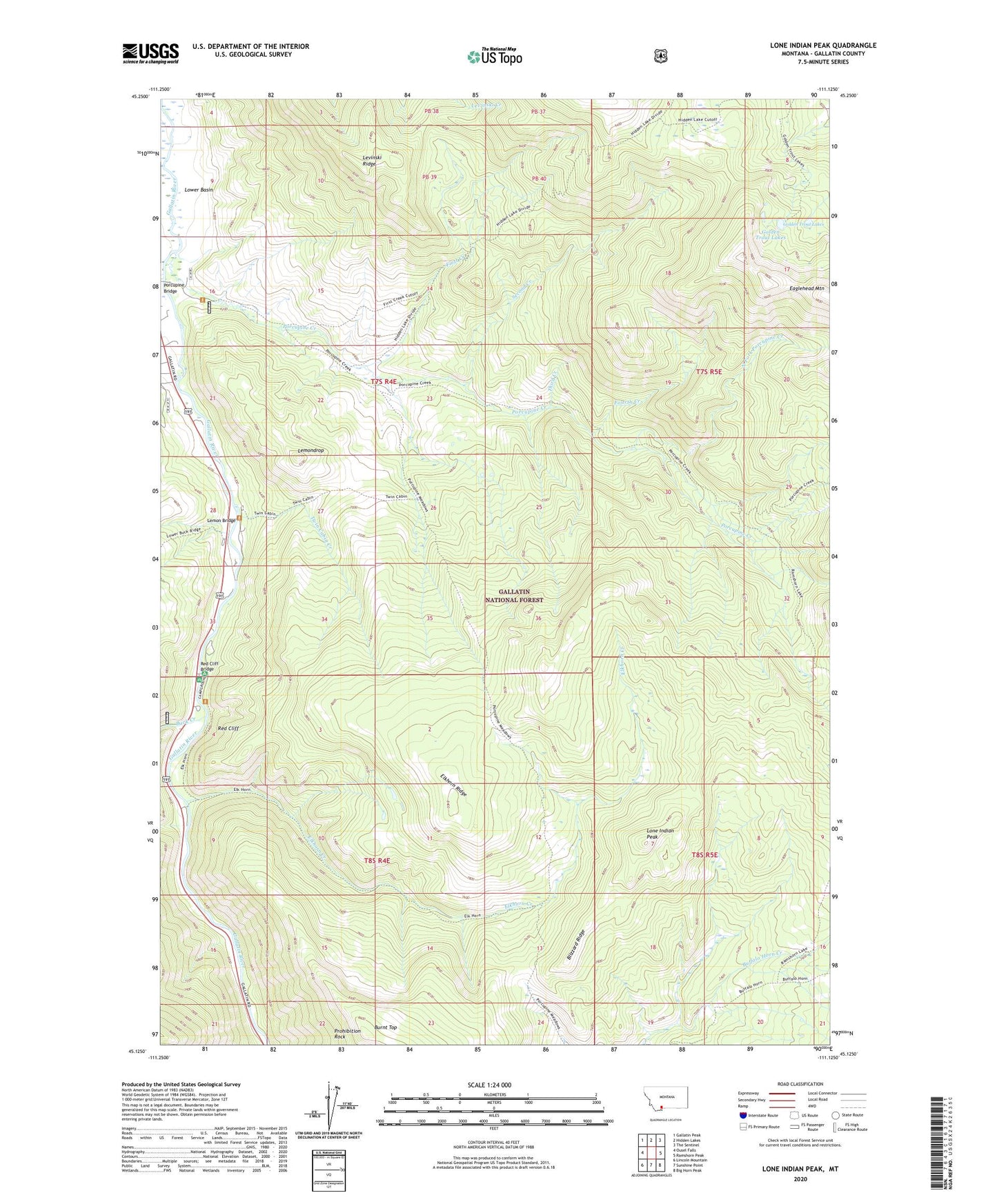
2020 topographic map quadrangle Lone Indian Peak in the state of Montana. Scale: 1:24000. Based on the newly updated USGS 7.5' US Topo map series, this map is in the following counties: Gallatin. The map contains contour data, water features, and other items you are used to seeing on USGS maps, but also has updated roads and other features. This is the next generation of topographic maps. Printed on high-quality waterproof paper with UV fade-resistant inks.
Quads adjacent to this one:
West: Ousel Falls
Northwest: Gallatin Peak
North: Hidden Lakes
Northeast: The Sentinel
East: Ramshorn Peak
Southeast: Big Horn Peak
South: Sunshine Point
Southwest: Lincoln Mountain
Contains the following named places: Beaver Creek, Blizzard Ridge, Buck Creek, Elkhorn Creek, Elkhorn Ridge, First Creek, Fourth Creek, Gallatin State Wildlife Management Area, Golden Trout Lakes, Half Way Inn, Lemon Bridge, Lemondrop, Levinski Ridge, Lone Indian Peak, Lower Basin, McGill Campground, North Fork Porcupine Creek, Porcupine Bridge, Porcupine Creek, Porcupine Forest Service Station, Porcupine Ranch, Prohibition Rock, Rainbow Ranch, Red Cliff, Red Cliff Bridge, Red Cliff Camp, Rhyolite Mine, Second Creek, State Game Range Headquarters, Third Creek, Twin Cabin Creek, ZIP Code: 59730