MyTopo
Lincoln Mountain Montana US Topo Map
Couldn't load pickup availability
Also explore the Lincoln Mountain Forest Service Topo of this same quad for updated USFS data
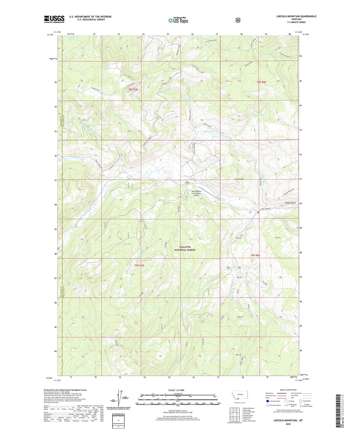
2024 topographic map quadrangle Lincoln Mountain in the state of Montana. Scale: 1:24000. Based on the newly updated USGS 7.5' US Topo map series, this map is in the following counties: Gallatin, Madison. The map contains contour data, water features, and other items you are used to seeing on USGS maps, but also has updated roads and other features. This is the next generation of topographic maps. Printed on high-quality waterproof paper with UV fade-resistant inks.
Quads adjacent to this one:
West: Koch Peak
Northwest: Sphinx Mountain
North: Ousel Falls
Northeast: Lone Indian Peak
East: Sunshine Point
Southeast: Upper Tepee Basin
South: Pika Point
Southwest: Hilgard Peak
This map covers the same area as the classic USGS quad with code o45111a3.
Contains the following named places: Albino Dam, Albino Lake, Almart/Walton Mine, Cache Creek, Deadhorse Creek, Eldridge Cabin, Eldridge Creek, Eldridge Trail, Left Fork Deadhorse Creek, Lincoln Mountain, Little Wapiti Creek, Marble Lake, Meadow Creek, Nine Quarter Circle Ranch, Nine Quarter Circle Ranch Airport, Slide Creek, Wapiti Creek, Wapiti F S Station, Wapiti Ranch Station, Wapiti Ridge Trail