MyTopo
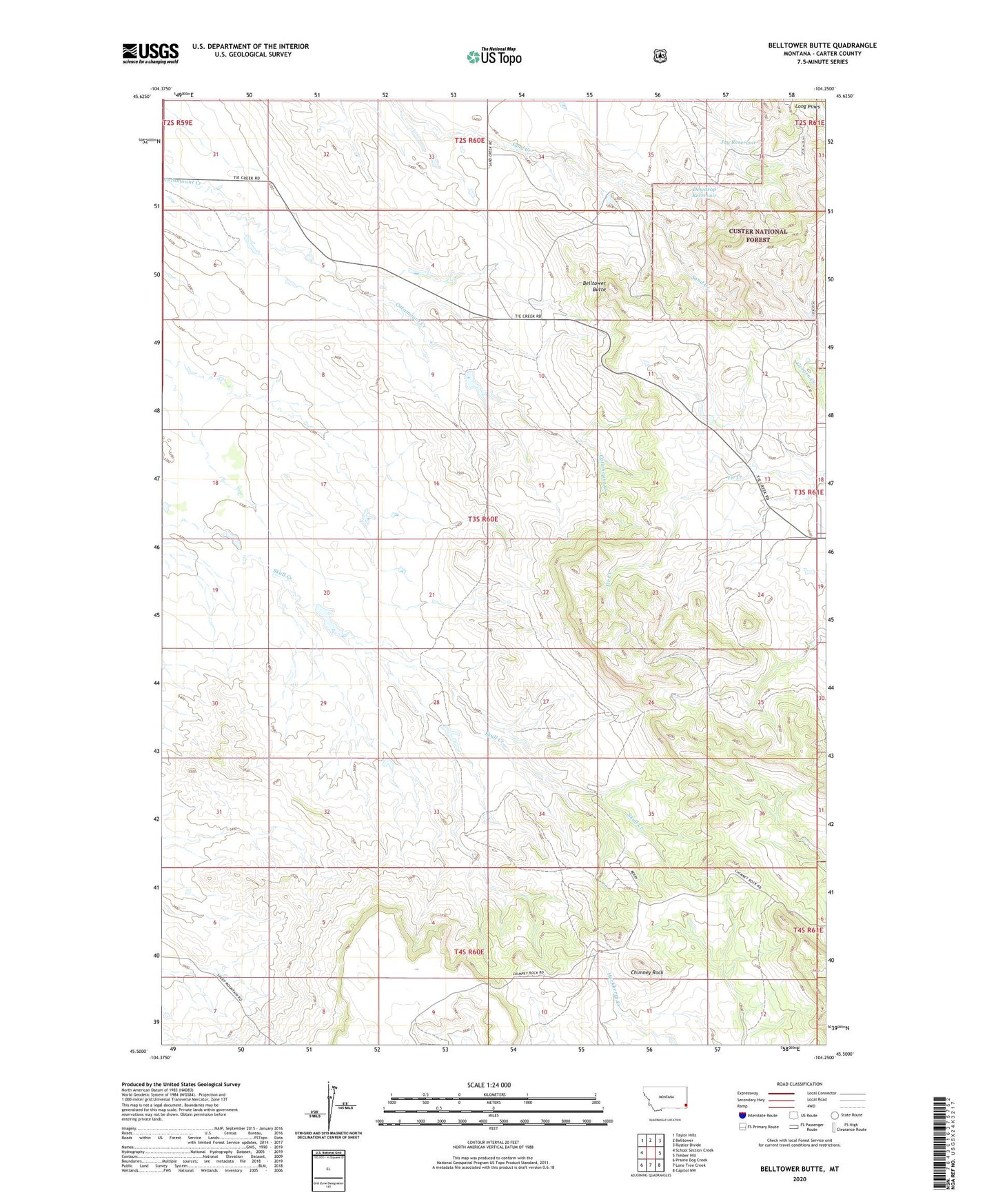
Belltower Butte Montana US Topo Map
Couldn't load pickup availability
Also explore the Belltower Butte Forest Service Topo of this same quad for updated USFS data
2024 topographic map quadrangle Belltower Butte in the state of Montana. Scale: 1:24000. Based on the newly updated USGS 7.5' US Topo map series, this map is in the following counties: Carter. The map contains contour data, water features, and other items you are used to seeing on USGS maps, but also has updated roads and other features. This is the next generation of topographic maps. Printed on high-quality waterproof paper with UV fade-resistant inks.
Quads adjacent to this one:
West: School Section Creek
Northwest: Taylor Hills
North: Belltower
Northeast: Rustler Divide
East: Timber Hill
Southeast: Capitol NW
South: Lone Tree Creek
Southwest: Prairie Dog Creek
This map covers the same area as the classic USGS quad with code o45104e3.
Contains the following named places: 03S60E11AB__01 Well, 03S60E24CDDC01 Well, Arp Post Office, Belltower Butte, Belltower Church, Chimney Rock, Dewdrop Reservoir, Excie Post Office, Jay Reservoir