MyTopo
Pine Hill Montana US Topo Map
Couldn't load pickup availability
Also explore the Pine Hill Forest Service Topo of this same quad for updated USFS data
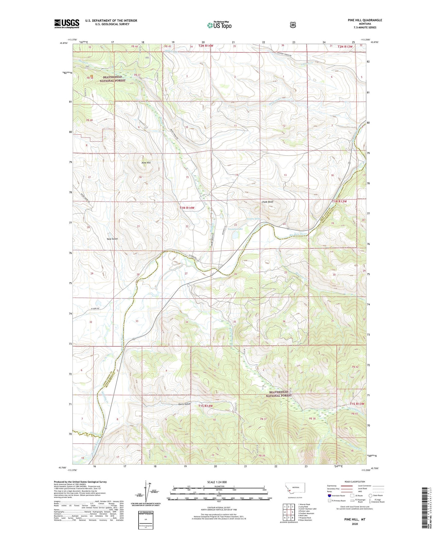
2024 topographic map quadrangle Pine Hill in the state of Montana. Scale: 1:24000. Based on the newly updated USGS 7.5' US Topo map series, this map is in the following counties: Deer Lodge, Beaverhead. The map contains contour data, water features, and other items you are used to seeing on USGS maps, but also has updated roads and other features. This is the next generation of topographic maps. Printed on high-quality waterproof paper with UV fade-resistant inks.
Quads adjacent to this one:
West: Pintler Lake
Northwest: Warren Peak
North: Long Peak
Northeast: Lower Seymour Lake
East: Foolhen Mountain
Southeast: Shaw Mountain
South: Proposal Rock
Southwest: Mud Lake
This map covers the same area as the classic USGS quad with code o45113g3.
Contains the following named places: 01N14W15DDDD01 Well, Ampo Ditch, Ampo Toomey Ditch, Bacon Ranch, Chalk Bluff, Christiansen Creek, Christianson Ranch, Goris Gulch, Mudd Creek, Nichols Ditch, Nichols Ranch, Papoose Creek, Pine Hill, Pintler Creek, Salefsky Creek, Sawlog Creek, Seefield Ditch, Shaw Creek, Smith Ranch, Squaw Creek, Stewart Creek, Toomey Creek, Toomey Lake, Toomey Spring, Wallace Christiansen Ranch, York Gulch