MyTopo
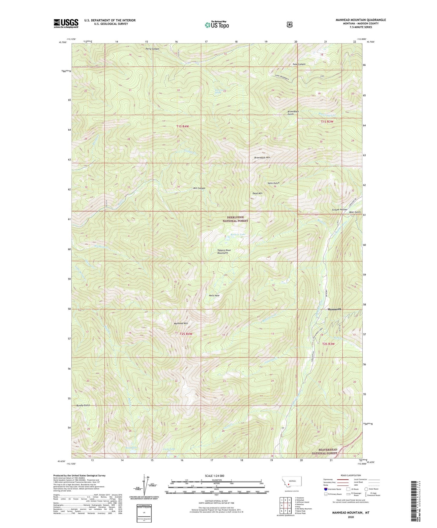
Manhead Mountain Montana US Topo Map
Couldn't load pickup availability
Also explore the Manhead Mountain Forest Service Topo of this same quad for updated USFS data
2024 topographic map quadrangle Manhead Mountain in the state of Montana. Scale: 1:24000. Based on the newly updated USGS 7.5' US Topo map series, this map is in the following counties: Madison. The map contains contour data, water features, and other items you are used to seeing on USGS maps, but also has updated roads and other features. This is the next generation of topographic maps. Printed on high-quality waterproof paper with UV fade-resistant inks.
Quads adjacent to this one:
West: Waterloo
Northwest: Vendome
North: Whitehall
Northeast: Jefferson Island
East: Pony
Southeast: Potosi Peak
South: Noble Peak
Southwest: Old Baldy Mountain
This map covers the same area as the classic USGS quad with code o45112f1.
Contains the following named places: Beall Lake, Bear Gulch, Brooks Creek Mine, Brownback Mountain, Cataract Creek, Coalpit Creek, Curly Creek, Curly Lake, Dead Mountain, Five Trough Spring, Grouse Hollow, Hells Hole, Mammoth, Mammoth Census Designated Place, Mammoth Mine, Mammoth Post Office, Mammoth School, Mammoth Tailings, Manhead Mountain, McGovern Creek, Park Creek, Perry Canyon II Mine, Rock Creek, Rock Creek Lake