MyTopo
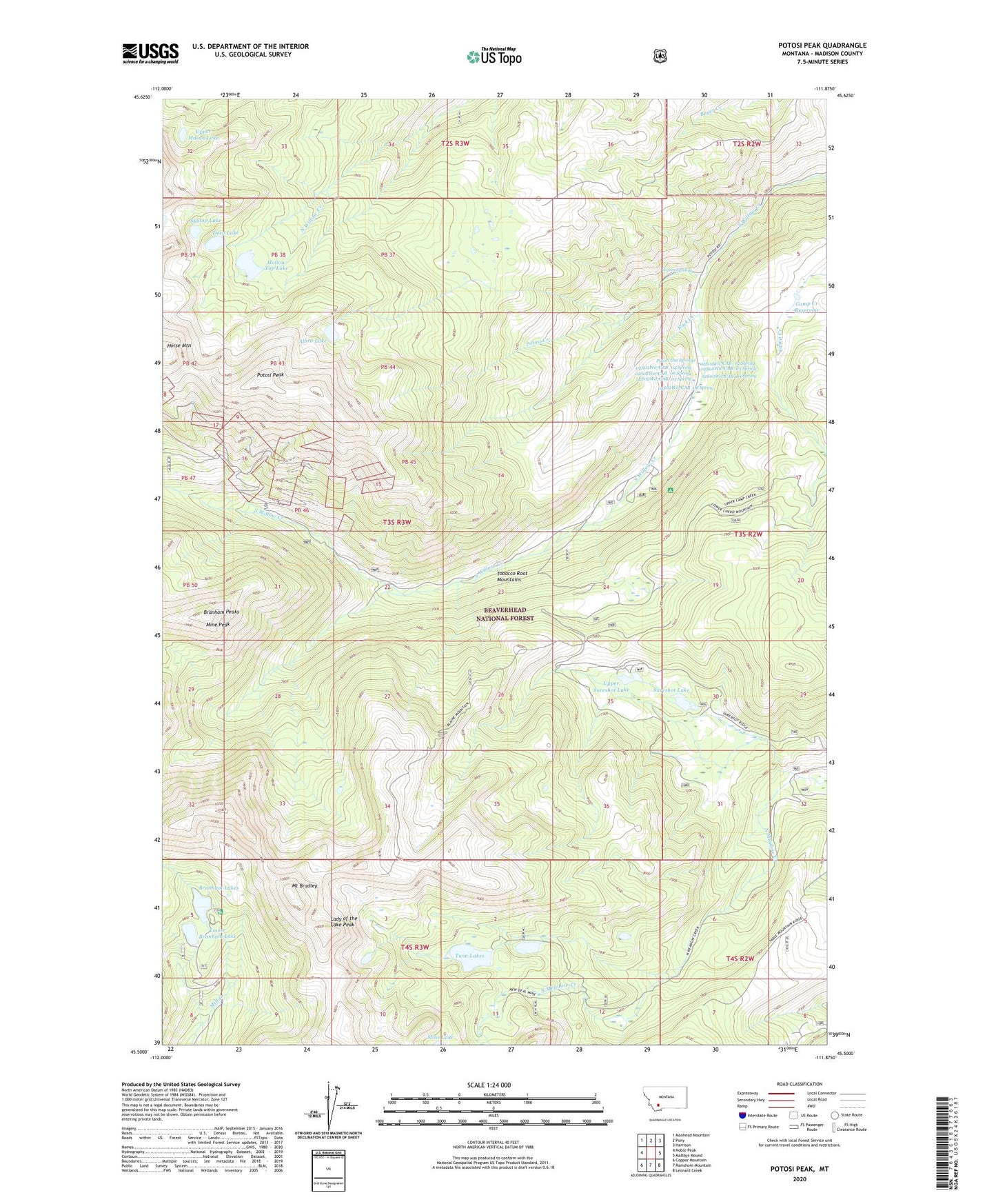
Potosi Peak Montana US Topo Map
Couldn't load pickup availability
Also explore the Potosi Peak Forest Service Topo of this same quad for updated USFS data
2024 topographic map quadrangle Potosi Peak in the state of Montana. Scale: 1:24000. Based on the newly updated USGS 7.5' US Topo map series, this map is in the following counties: Madison. The map contains contour data, water features, and other items you are used to seeing on USGS maps, but also has updated roads and other features. This is the next generation of topographic maps. Printed on high-quality waterproof paper with UV fade-resistant inks.
Quads adjacent to this one:
West: Noble Peak
Northwest: Manhead Mountain
North: Pony
Northeast: Harrison
East: Maltbys Mound
Southeast: Leonard Creek
South: Ramshorn Mountain
Southwest: Copper Mountain
This map covers the same area as the classic USGS quad with code o45111e8.
Contains the following named places: 02S01W07CAB_02 Spring, 02S02W07CAB_01 Spring, 02S02W07CAB_03 Spring, 02S02W07CAB_04 Spring, 02S02W07CAB_05 Spring, 02S02W07CAB_06 Spring, 02S02W07CAB_08 Spring, 10N03W27CADB01 Well, 59735, Albro Dam, Albro Lake, Belle Mine, Beulrh Mine, Beulrh Mine Camp, Branham Lakes, Branham Lakes Recreation Site, Branham Peaks, Bungalow Group, Camp Creek Reservoir, Deep Lake, Hollow Top Lake, Hollowtop Lake Dam, Lady of the Lake Peak, Lower Branham Dam, Lower Branham Lake, Mine Peak, Mount Bradley, NE NE Section 23 Mine, New Deal Mine, Potosi, Potosi Campground, Potosi Creek, Potosi Hot Springs, Potosi Peak, Potosi Peak Tungsten Mine, Potosi Ranger Station, Rock Creek, Skytop Lake, Sureshot Lake, Tungsten Mine, Twin Lakes, Upper Branham Dam, Upper Branham Lake, Upper Mason Lake, Upper Sureshot Lake, Warm Springs