MyTopo
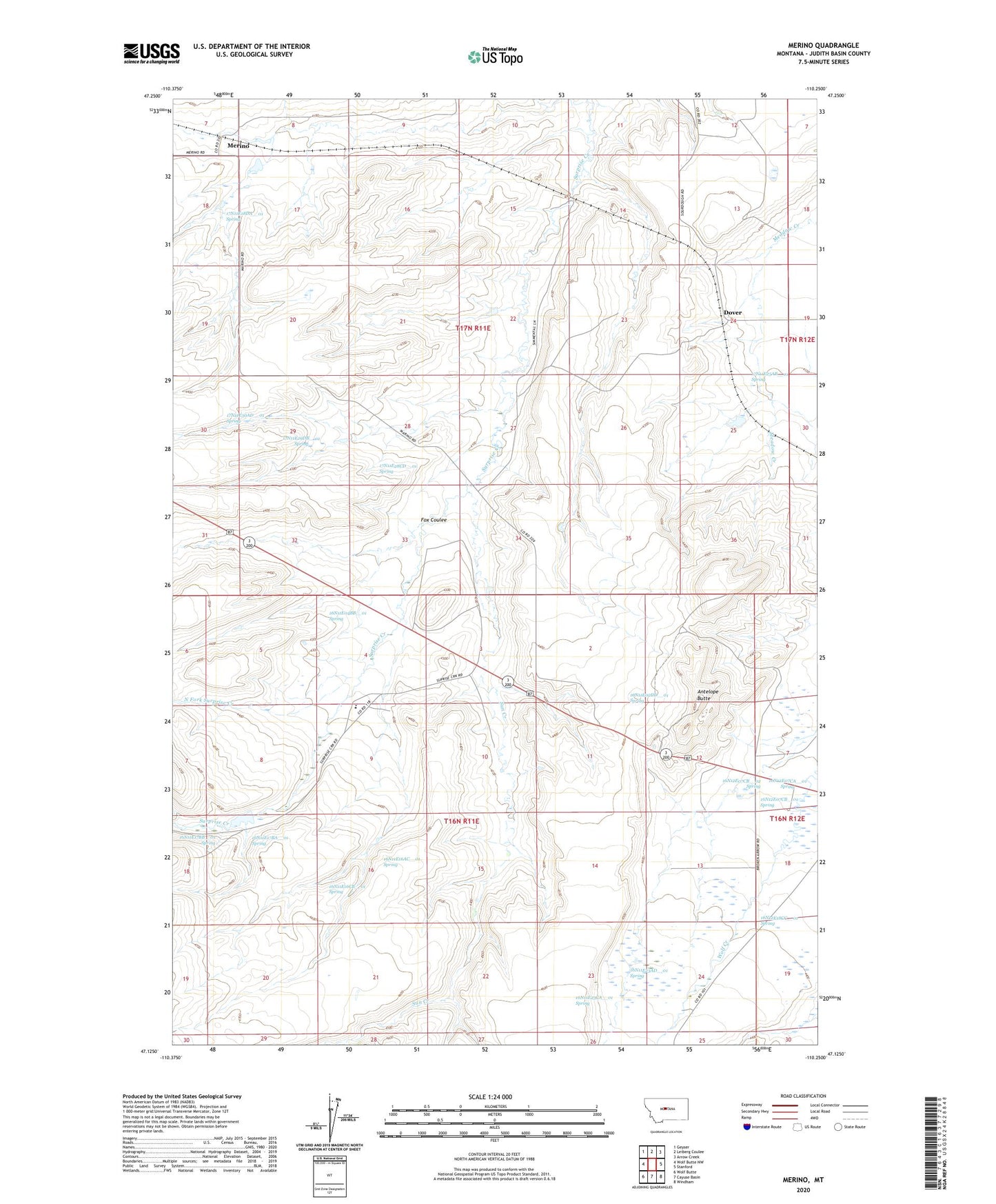
Merino Montana US Topo Map
Couldn't load pickup availability
2024 topographic map quadrangle Merino in the state of Montana. Scale: 1:24000. Based on the newly updated USGS 7.5' US Topo map series, this map is in the following counties: Judith Basin. The map contains contour data, water features, and other items you are used to seeing on USGS maps, but also has updated roads and other features. This is the next generation of topographic maps. Printed on high-quality waterproof paper with UV fade-resistant inks.
Quads adjacent to this one:
West: Wolf Butte NW
Northwest: Geyser
North: Leiberg Coulee
Northeast: Arrow Creek
East: Stanford
Southeast: Windham
South: Cayuse Basin
Southwest: Wolf Butte
This map covers the same area as the classic USGS quad with code o47110b3.
Contains the following named places: 16N11E02CB__01 Well, 16N11E02DD__01 Spring, 16N11E04BB__01 Spring, 16N11E04CD__01 Well, 16N11E04CD__02 Well, 16N11E04CDDC01 Well, 16N11E10AC__01 Well, 16N11E12AA__01 Well, 16N11E12AD__01 Well, 16N11E13A___01 Well, 16N11E13BB__01 Well, 16N11E13CC__01 Well, 16N11E16AC__01 Spring, 16N11E16CB__01 Spring, 16N11E17BA__01 Spring, 16N11E17BB__01 Spring, 16N11E20BD__01 Well, 16N11E23AD__01 Spring, 16N11E23CA__01 Spring, 16N11E24____01 Well, 16N11E24A___01 Well, 16N12E07BB__01 Well, 16N12E07BB__02 Well, 16N12E07CA__01 Spring, 16N12E07CB__01 Spring, 16N12E07CB__02 Spring, 16N12E07DC__01 Well, 16N12E07DC__02 Well, 16N12E18BA__01 Well, 16N12E18CC__01 Spring, 17N11E07DD__01 Well, 17N11E08DA__01 Well, 17N11E12DB__01 Well, 17N11E18AA__01 Well, 17N11E18DA__01 Spring, 17N11E23BD__01 Well, 17N11E25AB__01 Spring, 17N11E27BA__01 Well, 17N11E27CAAB01 Well, 17N11E28CD__01 Spring, 17N11E29DB__01 Spring, 17N11E30AD__01 Spring, 17N11E33AC__01 Well, 17N11E33DB__01 Well, 17N11E33DD__01 Well, 17N12E19CB__01 Well, Antelope Butte, Dover, Dover Post Office, Fox Coulee, Longs, Merino, Merino Post Office, Merino School, North Fork Surprise Creek, Sun Creek, Surprise Creek Colony, Surprise Creek Colony Census Designated Place, Surprise Creek Colony School, Tobin, Wendall Willkie Dam, Wilson Dam