MyTopo
Leiberg Coulee Montana US Topo Map
Couldn't load pickup availability
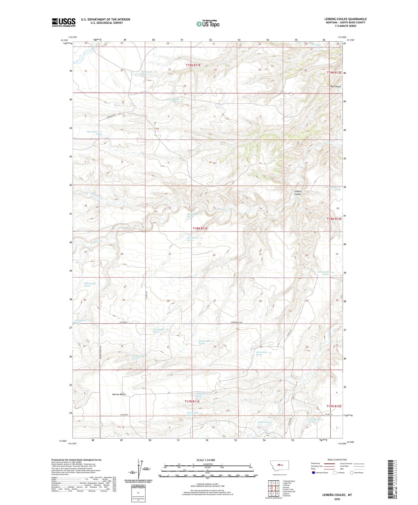
2024 topographic map quadrangle Leiberg Coulee in the state of Montana. Scale: 1:24000. Based on the newly updated USGS 7.5' US Topo map series, this map is in the following counties: Judith Basin. The map contains contour data, water features, and other items you are used to seeing on USGS maps, but also has updated roads and other features. This is the next generation of topographic maps. Printed on high-quality waterproof paper with UV fade-resistant inks.
Quads adjacent to this one:
West: Geyser
Northwest: Palisade Butte
North: Jiggs Flat
Northeast: Pownal
East: Arrow Creek
Southeast: Stanford
South: Merino
Southwest: Wolf Butte NW
This map covers the same area as the classic USGS quad with code o47110c3.
Contains the following named places: 17N11E03CB__01 Spring, 17N11E04DD__01 Spring, 17N11E05BD__01 Well, 17N11E05DB__01 Well, 17N11E05DB__02 Well, 17N11E12AB__01 Spring, 18N11E04AB__01 Spring, 18N11E05CC__01 Spring, 18N11E06CD__01 Well, 18N11E06CD__02 Well, 18N11E06CD__03 Well, 18N11E06CD__04 Well, 18N11E06CD__05 Well, 18N11E16DA__01 Spring, 18N11E21AA__01 Spring, 18N11E22AB__01 Well, 18N11E22AB__02 Well, 18N11E22CC__01 Well, 18N11E22DB__01 Well, 18N11E24DD__01 Well, 18N11E24DD__02 Spring, 18N11E28DB__01 Well, 18N11E28DB__02 Well, 18N11E30AB__01 Spring, 18N11E30CD__01 Spring, 18N11E32BB__01 Well, 18N11E32DB__01 Spring, 18N11E33BB__01 Spring, 18N11E34BC__01 Spring, 18N11E35AD__01 Well, 18N11E35CA__01 Spring, 19N11E32DA__01 Well, 19N11E32DA__02 Well, 19N11E32DA__03 Spring, 19N11E32DB__01 Well, Braun Creek, Complimentary Dam, Leiberg Coulee, Merino Bench