
MyTopo
Miner Montana US Topo Map
Couldn't load pickup availability
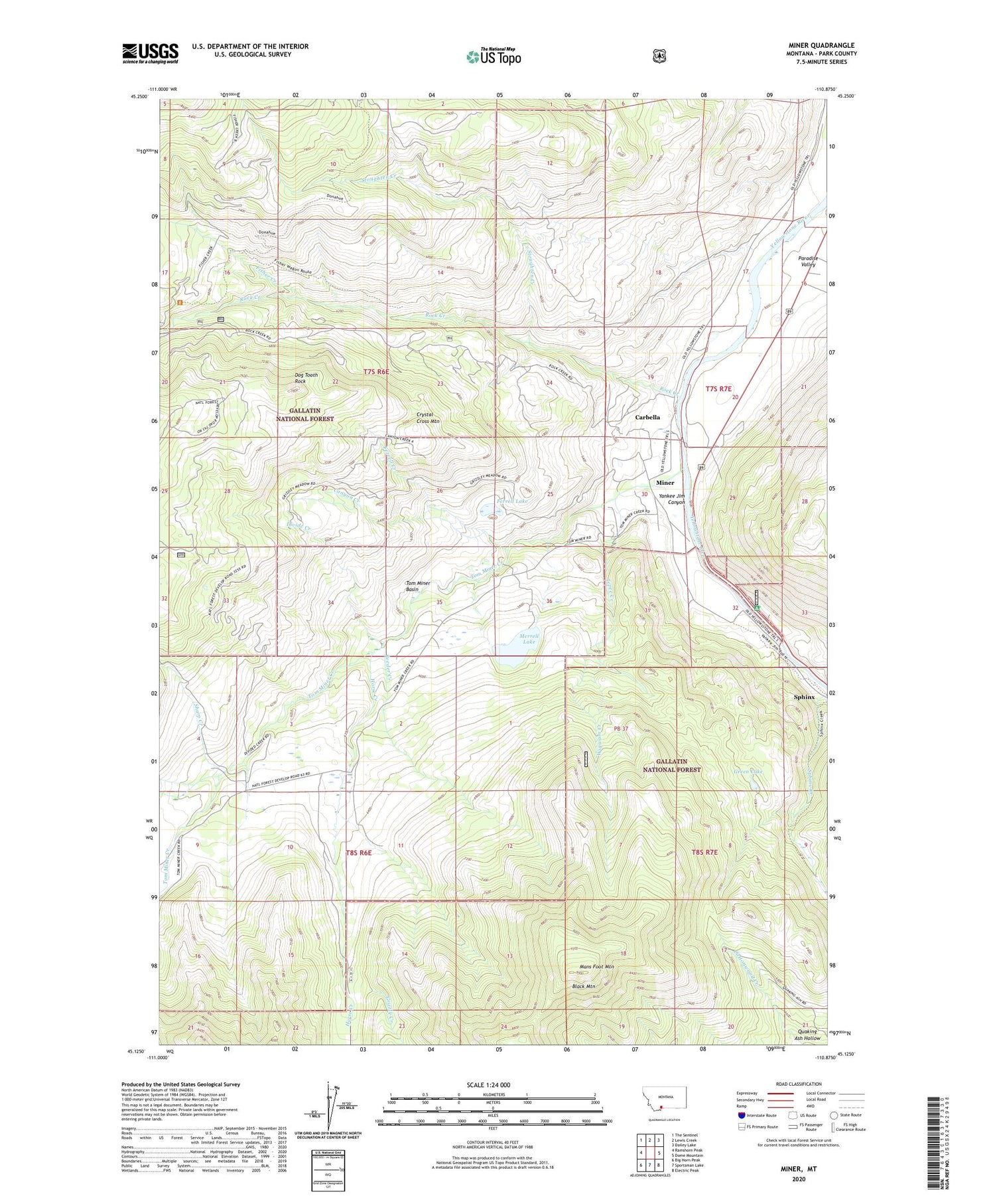
2020 topographic map quadrangle Miner in the state of Montana. Scale: 1:24000. Based on the newly updated USGS 7.5' US Topo map series, this map is in the following counties: Park. The map contains contour data, water features, and other items you are used to seeing on USGS maps, but also has updated roads and other features. This is the next generation of topographic maps. Printed on high-quality waterproof paper with UV fade-resistant inks.
Quads adjacent to this one:
West: Ramshorn Peak
Northwest: The Sentinel
North: Lewis Creek
Northeast: Dailey Lake
East: Dome Mountain
Southeast: Electric Peak
South: Sportsman Lake
Southwest: Big Horn Peak
Contains the following named places: Black Mountain, Canyon Creek, Carbella, Carbella Campground, Carbella Post Office, Carbella Recreation Site, Carbella School, Crystal Cross Mountain, Divide Creek, Dog Tooth Rock, Ferrell Creek, Ferrell Lake, Fisher Creek, Green Lake, Grizzly Creek, Horse Creek, Mans Foot Mountain, Merrell Dam, Merrell Lake, Middle Creek, Miner, Miner Post Office, Miner School, Pine Creek, Quaking Ash Hollow, Reeder Creek, Rock Creek, Sharp Creek, Sphinx, Stoughten Creek, Tepee Creek, Tom Miner Basin, Tom Miner Creek, Wigwam Creek, Yankee Jim Campground and Picnic Area, Yankee Jim Canyon, ZIP Code: 59027


