MyTopo
Mixes Baldy Montana US Topo Map
Couldn't load pickup availability
Also explore the Mixes Baldy Forest Service Topo of this same quad for updated USFS data
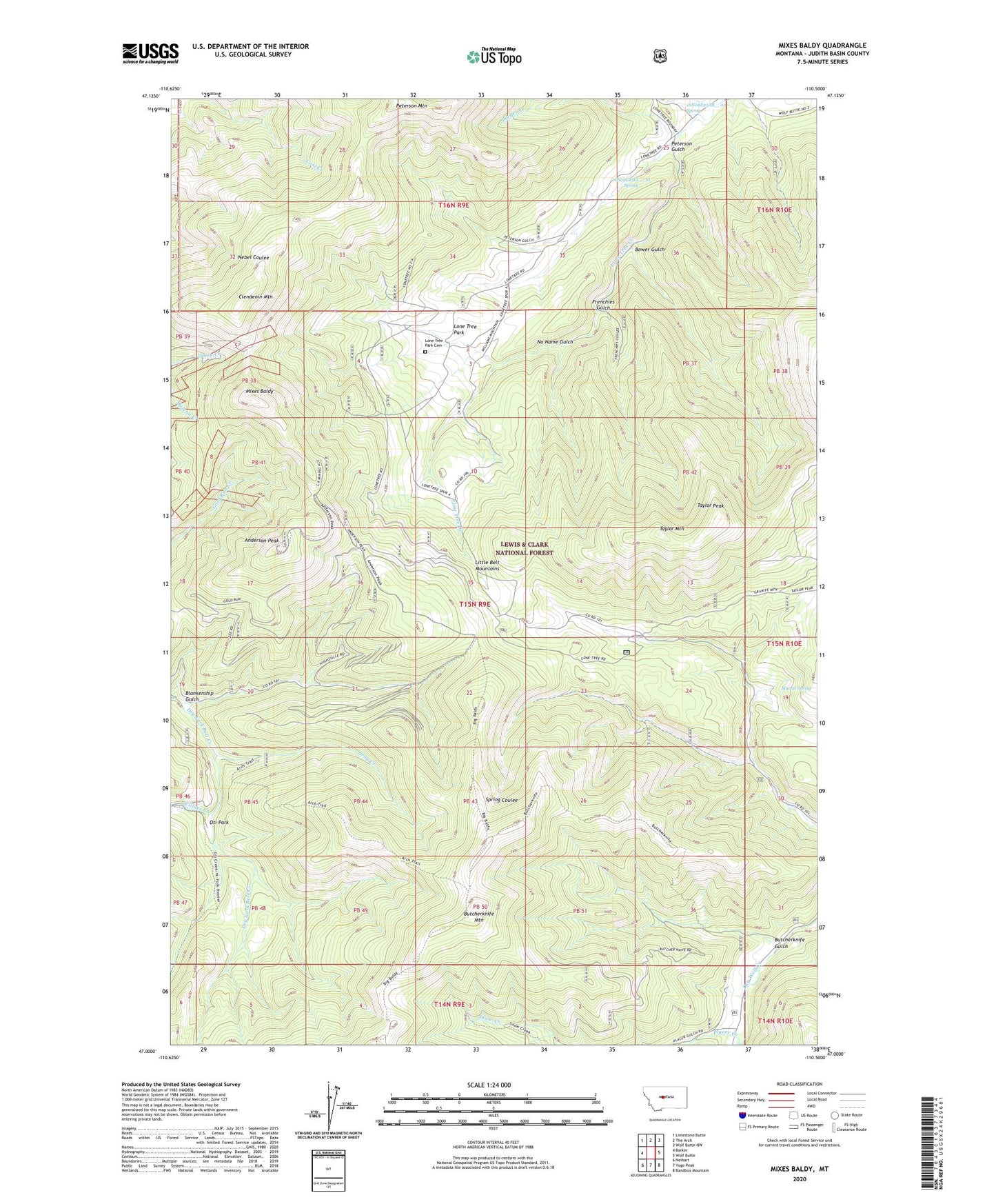
2024 topographic map quadrangle Mixes Baldy in the state of Montana. Scale: 1:24000. Based on the newly updated USGS 7.5' US Topo map series, this map is in the following counties: Judith Basin. The map contains contour data, water features, and other items you are used to seeing on USGS maps, but also has updated roads and other features. This is the next generation of topographic maps. Printed on high-quality waterproof paper with UV fade-resistant inks.
Quads adjacent to this one:
West: Barker
Northwest: Limestone Butte
North: The Arch
Northeast: Wolf Butte NW
East: Wolf Butte
Southeast: Bandbox Mountain
South: Yogo Peak
Southwest: Neihart
This map covers the same area as the classic USGS quad with code o47110a5.
Contains the following named places: 16N09E25AB__01 Spring, 16N09E25CC__01 Spring, 16N09E26D___01 Well, Anderson Peak, Berger Creek, Blankenship Gulch, Bower Gulch, Butcherknife Gulch, Butcherknife Mountain, Clendenin Mountain, Frenchies Gulch, Geer Post Office, Gray Creek, Harrison/Moulton Mine, Lone Tree Park, Lone Tree Park Cemetery, Martin Spring, Mixes Baldy, Montgomery Mine, Moulton Mine, NE SE Section 31 Mine, NE SW Section 22 Mine, Niles Post Office, No Name Gulch, NW SW Section 22 Mine, Oti Park, Peterson Gulch, Peterson Mountain, Placer Creek, Taylor Mountain, Taylor Peak, Tiger Mine, Villars Creek