MyTopo
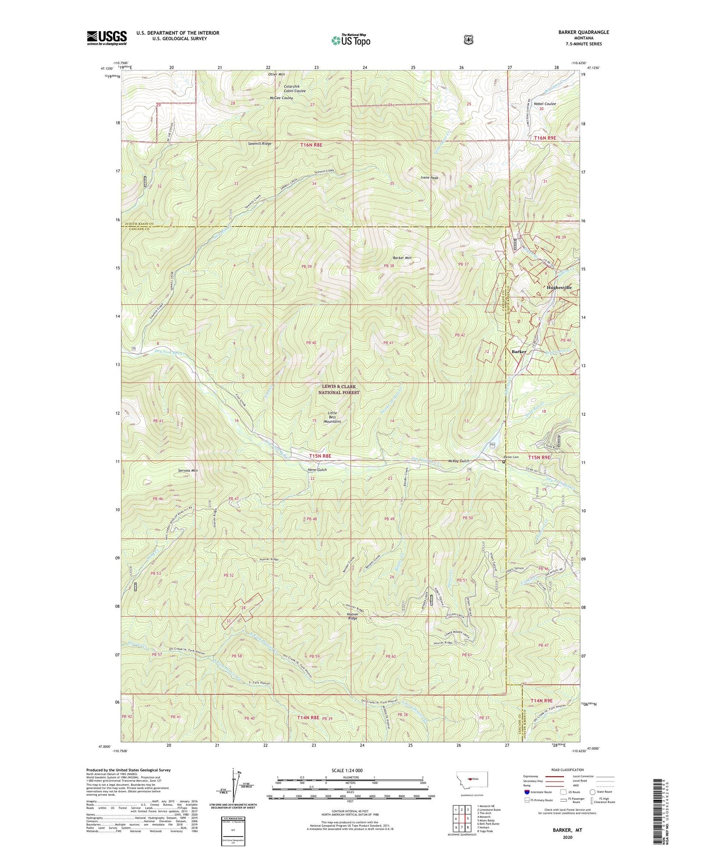
Barker Montana US Topo Map
Couldn't load pickup availability
Also explore the Barker Forest Service Topo of this same quad for updated USFS data
2024 topographic map quadrangle Barker in the state of Montana. Scale: 1:24000. Based on the newly updated USGS 7.5' US Topo map series, this map is in the following counties: Cascade, Judith Basin. The map contains contour data, water features, and other items you are used to seeing on USGS maps, but also has updated roads and other features. This is the next generation of topographic maps. Printed on high-quality waterproof paper with UV fade-resistant inks.
Quads adjacent to this one:
West: Monarch
Northwest: Monarch NE
North: Limestone Butte
Northeast: The Arch
East: Mixes Baldy
Southeast: Yogo Peak
South: Neihart
Southwest: Belt Park Butte
This map covers the same area as the classic USGS quad with code o47110a6.
Contains the following named places: Barker, Barker Cemetery, Barker Mine, Barker Mountain, Barker Post Office, Barker School, Belfont/Harrison Mine, Belt/Grace/Marcelline Mine, Bend Gulch Creek, Bender Creek, Block P Powder Magazine Mine, Block P Tailings, Bon Ton Mine, Centerville, Charcoal Creek, Daisy Creek, Edwards Mine, Fairplay Mine, Finn Creek, Galena, Galena Creek, Gold Run Creek, Green Creek, Grey Eagle Mine, Henn Gulch, Hoover Ridge, Hughesville, Hughesville Post Office, Hughesville School, Irene Peak, Leadville, M T A Mine, Marcelline Mine, May Mine, McKay Gulch, McKay Mine, Middle Fork Hoover Creek, MS 3048 Mine, Myrtle Navy Mine, NE NE Section 30 Mine, NE SE Section 7 Mine, Nebel Coulee, North Fork Hoover Creek, NW NE Section 31 Mine, NW SW Section 7 Mine, Otter Mountain, Paragon Mine, Pride of the West Mine, Puzzler Mine, Sawmill Creek, Sawmill Ridge, SE SE Section 1 Mine, Servoss Mountain, Setter Post Office, Smelter Mine, Smoke-in-Hole Creek, South Fork Hoover Creek, Spruce Creek, Summit, SW NE Section 1 Mine, SW NW Section 06 Mine, SW SE Section 30 Mine, SW SE Section 7 Mine, Vista/NW NW Section 6 Mine, Wright Lode Mine


