MyTopo
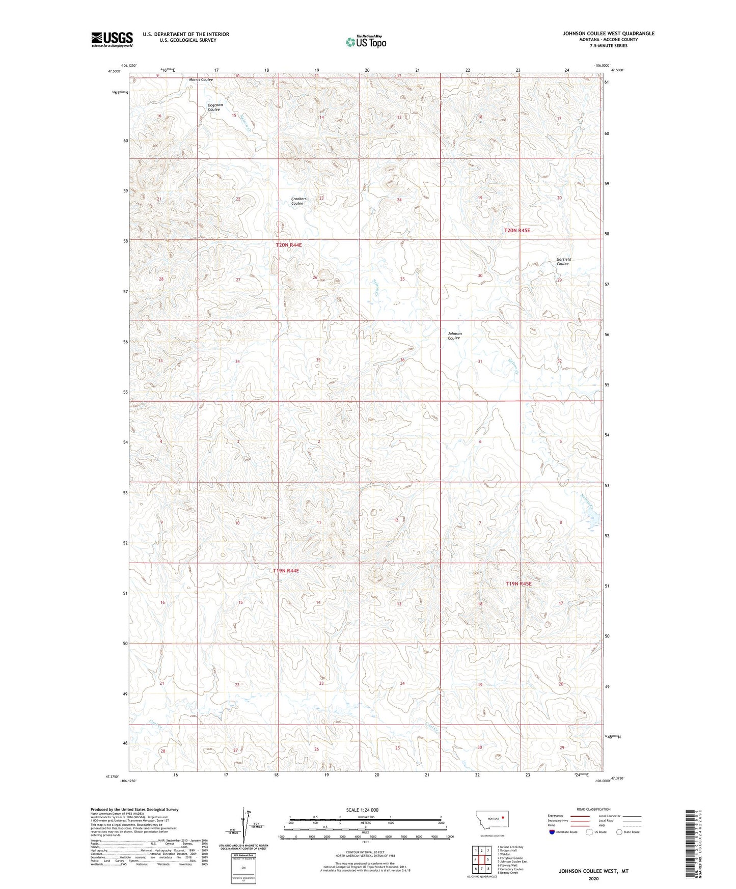
Johnson Coulee West Montana US Topo Map
Couldn't load pickup availability
2024 topographic map quadrangle Johnson Coulee West in the state of Montana. Scale: 1:24000. Based on the newly updated USGS 7.5' US Topo map series, this map is in the following counties: McCone. The map contains contour data, water features, and other items you are used to seeing on USGS maps, but also has updated roads and other features. This is the next generation of topographic maps. Printed on high-quality waterproof paper with UV fade-resistant inks.
Quads adjacent to this one:
West: Fortyfour Coulee
Northwest: Nelson Creek Bay
North: Rodgers Hall
Northeast: Weldon
East: Johnson Coulee East
Southeast: Beauty Creek
South: Cemetery Coulee
Southwest: Flowing Well
This map covers the same area as the classic USGS quad with code o47106d1.
Contains the following named places: 19N44E01ADCD01 Well, 19N44E09CBAA01 Well, 19N45E06CCCD01 Well, 20N44E24BDAC01 Well, 20N44E27CBDA01 Well, 20N45E17CCBB01 Well, 20N45E19DDDD01 Well, 20N45E20DDBC01 Well, 20N45E30DBAB01 Well, Crookers Coulee, Dogtown Coulee, Dreyer Brothers Incorporated Number 1 Dam, Garfield Coulee, Hannaland Number 1 Dam, Johnson Coulee, Morris Coulee, Murphy Number 2 Dam, South Fork Nelson Creek