MyTopo
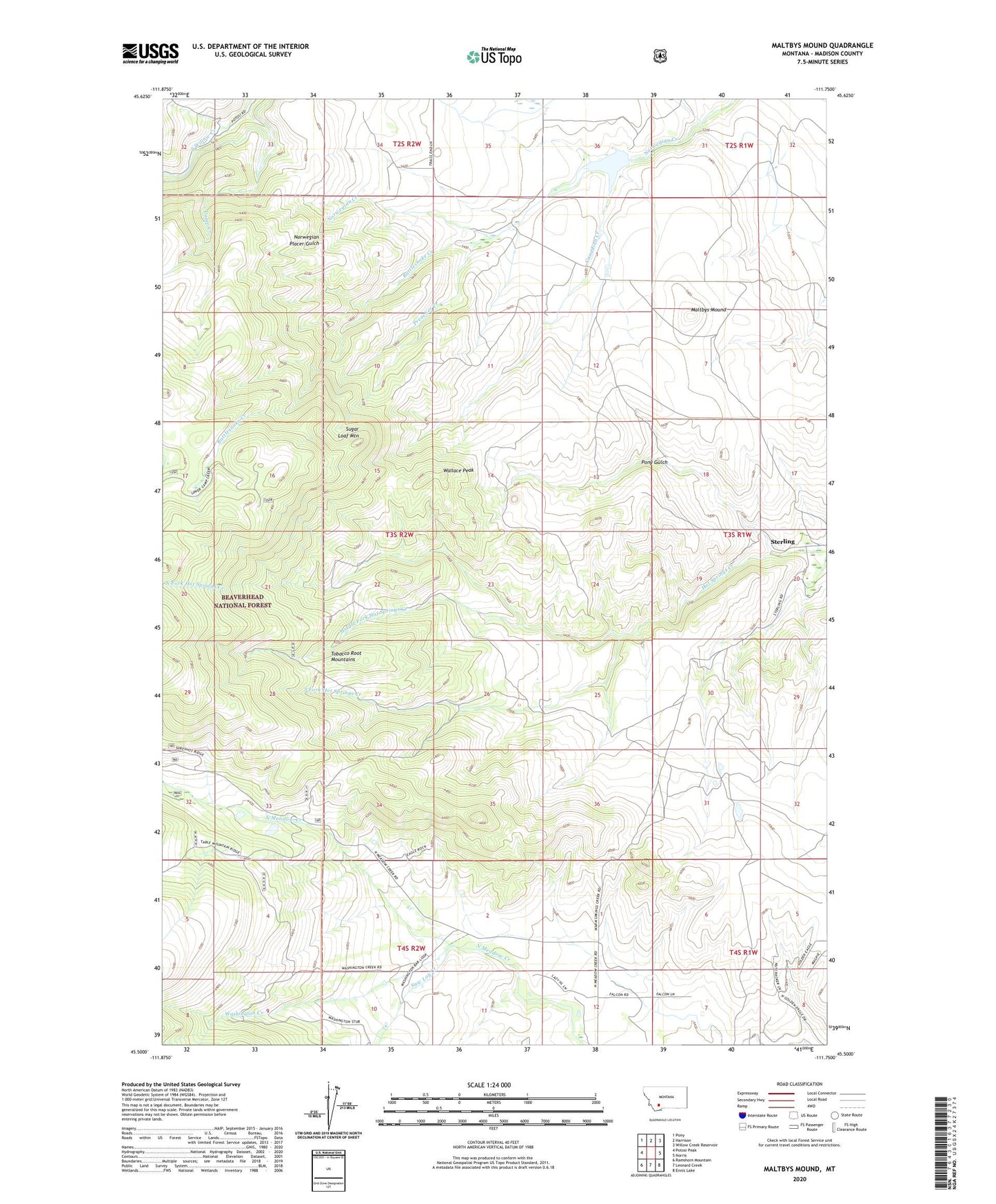
Maltbys Mound Montana US Topo Map
Couldn't load pickup availability
Also explore the Maltbys Mound Forest Service Topo of this same quad for updated USFS data
2024 topographic map quadrangle Maltbys Mound in the state of Montana. Scale: 1:24000. Based on the newly updated USGS 7.5' US Topo map series, this map is in the following counties: Madison. The map contains contour data, water features, and other items you are used to seeing on USGS maps, but also has updated roads and other features. This is the next generation of topographic maps. Printed on high-quality waterproof paper with UV fade-resistant inks.
Quads adjacent to this one:
West: Potosi Peak
Northwest: Pony
North: Harrison
Northeast: Willow Creek Reservoir
East: Norris
Southeast: Ennis Lake
South: Leonard Creek
Southwest: Ramshorn Mountain
This map covers the same area as the classic USGS quad with code o45111e7.
Contains the following named places: 04S02W01CACC01 Well, Arctic/Monitor Mine, Arkansas Mine, Aurora Creek, Belle of Tennessee Mine, Billy Mine, Brooklyn/Black Prince Mine, Camp Creek, Canadian Creek, Columbus Mine, Cousin Jeny/Lomonica Mine, Emperor Mine, Galena Mine, Galena Minor Mine, Idaho Mine, Lehigh Group Mine, Lexington Mine, Maltbys Mound, Mary A Mine, Midasburg, Middle Fork Hot Springs Creek, NE NW Section 9 Mine, NE SE Section 31 Mine, NE SW Section 12 Mine, New York Belle Mine, North Fork Hot Springs Creek, North Meadow Creek Dam, Norwegian Mine, Norwegin Creek Dam, NW SW Section 25 Mine, NW SW Section 6 Mine, Pauline Mine, Pearl Mine, Polaris Mine, Pony Gulch, Pony Gulch Mine, Preacher Creek, Rattlesnake Creek, Revenue, Revenue Mine, Revenue Post Office, Revenue School, Saw Log Creek, SE NW Section 20 Mine, SE NW Section 29 Mine, South Fork Hot Springs Creek, Sterling, Sterling Post Office, Sterling School, Sugar Loaf Mountain, SW SE Section 25 Mine, Wallace Peak, Washington Bar Placer Mine, Washington Creek, Washington Creek Group Placer Mine