MyTopo
Dayton North Wyoming US Topo Map
Couldn't load pickup availability
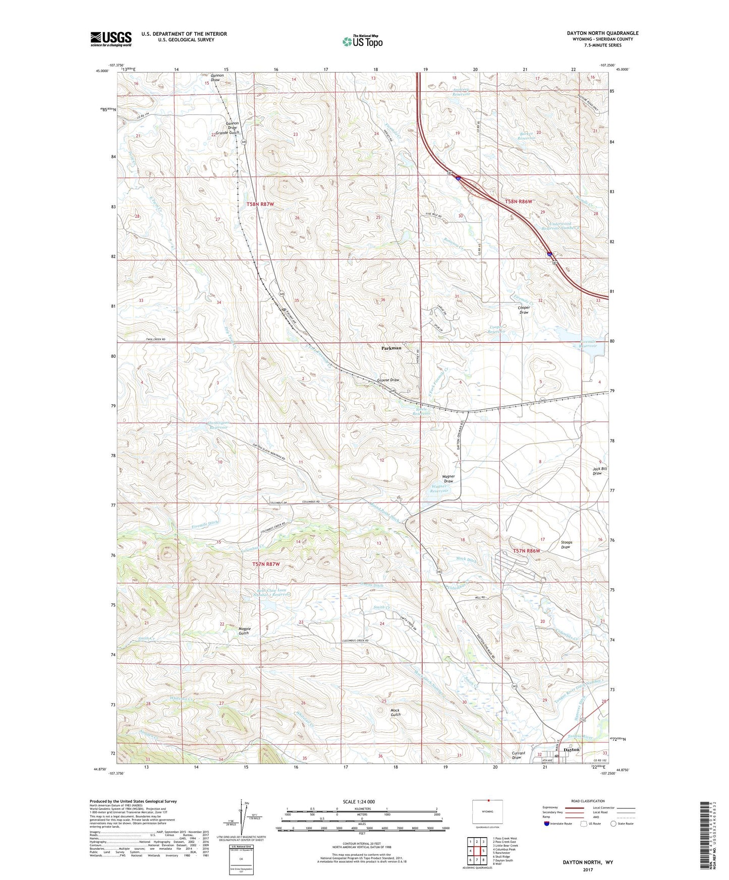
2021 topographic map quadrangle Dayton North in the state of Wyoming. Scale: 1:24000. Based on the newly updated USGS 7.5' US Topo map series, this map is in the following counties: Sheridan. The map contains contour data, water features, and other items you are used to seeing on USGS maps, but also has updated roads and other features. This is the next generation of topographic maps. Printed on high-quality waterproof paper with UV fade-resistant inks.
Quads adjacent to this one:
West: Columbus Peak
Northwest: Pass Creek West
North: Pass Creek East
Northeast: Little Bear Creek
East: Ranchester
Southeast: Wolf
South: Dayton South
Southwest: Skull Ridge
This map covers the same area as the classic USGS quad with code o44107h3.
Contains the following named places: Antwerp Dam, Antwerp Reservoir, Ashenbach Dam, Ashenbach Reservoir, Barker Reservoir, Bear Claw Love Number 1 Dam, Bear Claw Love Number 1 Reservoir, Bear Claw Ranch, Bonanza Creek, Brand Point Ditch, Cooper Dam, Cooper Draw, Cooper Reservoir, Currant Draw, Dayton, Dayton Post Office, Dry Twin Creek, East Twin Creek, Fivemile Ditch, Fivemile Reservoir, Gannon Draw, Grande Gulch, Grouse Draw, Huntington Dam, Huntington Reservoir, Little Tongue River, Magpie Gulch, Mock Bass Dam, Mock Bass Reservoir, Mock Ditch, Mock Ditch Number 2, Owen Brothers Dam, Owen Brothers Reservoir, Owens Ditch, Padlock Number 1 A Five Mile Dam, Padlock Number 1 A Five Mile Reservoir, Padlock Ranch, Parkman, Parkman Census Designated Place, Parkman Post Office, Slack School, Smith Creek, South Fork Fivemile Creek, Steele Reservoir, Tongue River Ditch Number 1, Tongue River High School, Underwood Reservoir Number 2, Wagner Dam, Wagner Draw, Wagner Reservoir