MyTopo
Petty Mountain Montana US Topo Map
Couldn't load pickup availability
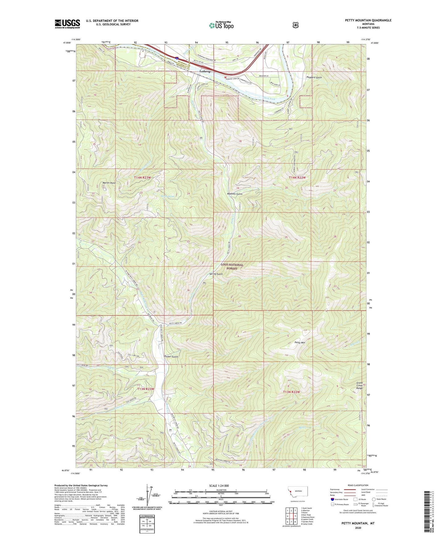
2020 topographic map quadrangle Petty Mountain in the state of Montana. Scale: 1:24000. Based on the newly updated USGS 7.5' US Topo map series, this map is in the following counties: Missoula, Mineral. The map contains contour data, water features, and other items you are used to seeing on USGS maps, but also has updated roads and other features. This is the next generation of topographic maps. Printed on high-quality waterproof paper with UV fade-resistant inks.
Quads adjacent to this one:
West: Deer Peak
Northwest: Stark South
North: Alberton
Northeast: Huson
East: Diamond Point
Southeast: Camp Creek
South: Garden Point
Southwest: Lupine Creek
Contains the following named places: 14N22W08BBDA01 Well, 14N22W08BDDA01 Well, Bruce Creek, Circle S Ranch, Coppersmith Mine, Eds Creek, Frenchtown Rural Fire District Station 5, Inverness Group Mine, Johns Creek, Kirchey Creek, Lothrop, Lothrop Post Office, Madison Gulch, Martin Point, Martin Spring, Peppard Gulch, Petty Creek, Petty Creek Fishing Access Site, Petty Mountain, Reservoir Creek, Ross, Shangville, Spring Gulch, Teller Barite Mine, Tucker Gulch, West Fork Petty Creek