MyTopo
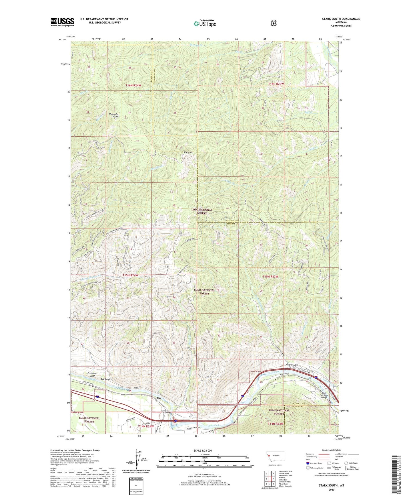
Stark South Montana US Topo Map
Couldn't load pickup availability
Also explore the Stark South Forest Service Topo of this same quad for updated USFS data
2024 topographic map quadrangle Stark South in the state of Montana. Scale: 1:24000. Based on the newly updated USGS 7.5' US Topo map series, this map is in the following counties: Mineral, Missoula. The map contains contour data, water features, and other items you are used to seeing on USGS maps, but also has updated roads and other features. This is the next generation of topographic maps. Printed on high-quality waterproof paper with UV fade-resistant inks.
Quads adjacent to this one:
West: Tarkio
Northwest: Horsehead Peak
North: Stark North
Northeast: McCormick Peak
East: Alberton
Southeast: Petty Mountain
South: Deer Peak
Southwest: Williams Peak
This map covers the same area as the classic USGS quad with code o47114a5.
Contains the following named places: 16N23W27BBCC01 Well, Adams Creek, Bestwick Creek, Clark Fork River Bridge, Cyr, Cyr Bridge, Cyr Bridge Fishing Access Site, Cyr Census Designated Place, Cyr Post Office, Cyr School, Dry Gulch, Freezeout Gulch, Moose Creek, Mountain Creek, Natural Pier Fishing Access Site, Negro Gulch, Ninemile Divide, Plateau, Saint Johns Fishing Access Site, Stark Mountain, Stark Mountain Lookout, Stark Mountain Vista, West Mountain Creek