MyTopo
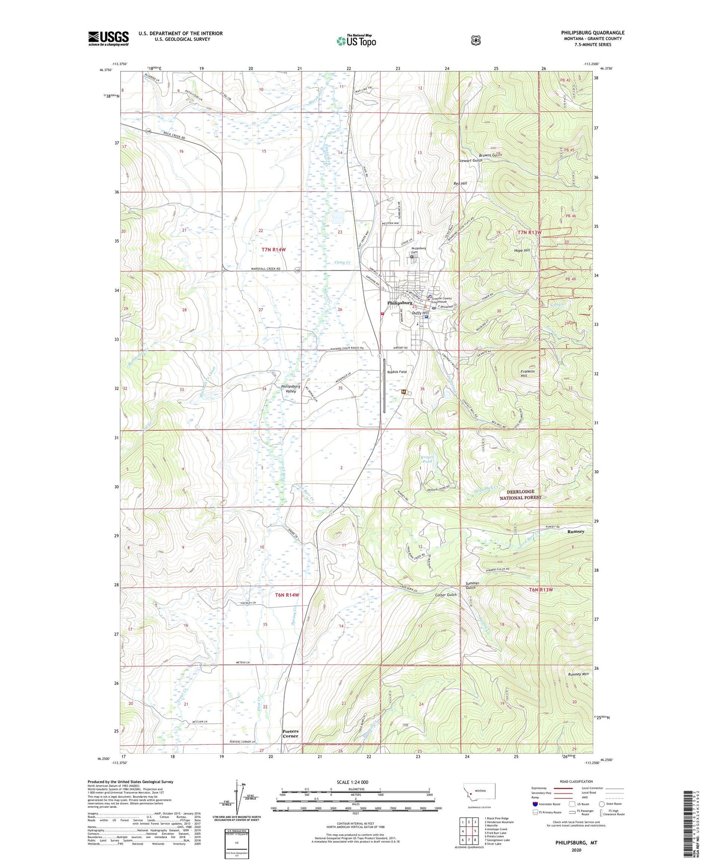
Philipsburg Montana US Topo Map
Couldn't load pickup availability
Also explore the Philipsburg Forest Service Topo of this same quad for updated USFS data
2024 topographic map quadrangle Philipsburg in the state of Montana. Scale: 1:24000. Based on the newly updated USGS 7.5' US Topo map series, this map is in the following counties: Granite. The map contains contour data, water features, and other items you are used to seeing on USGS maps, but also has updated roads and other features. This is the next generation of topographic maps. Printed on high-quality waterproof paper with UV fade-resistant inks.
Quads adjacent to this one:
West: Antelope Creek
Northwest: Black Pine Ridge
North: Henderson Mountain
Northeast: Maxville
East: Fred Burr Lake
Southeast: Silver Lake
South: Georgetown Lake
Southwest: Potato Lakes
This map covers the same area as the classic USGS quad with code o46113c3.
Contains the following named places: Algonquin Mine, Allen Hospital, Baier Mine, Baptist Church, Bathhouse Creek, Bayer Number 1 Dam, Browns Gulch, Camp Creek, Clark, Cliff Gulch Mine, Colter Gulch, Cow Creek, Derby/Elienore Mine, Dirty Dick Creek, Douglas Creek, Douglas Creek Mine, Duffy Hill, Durango Mine, Field/Porter Mine, First Presbyterian Church, Franklin Hill, Fred Burr Creek, Frost Creek, Granite County Courthouse, Granite County Medical Center, Granite County Memorial Hospital Heliport, Granite County Memorial Medical Assistance Facility, Granite County Memorial Nursing Home, Granite County Museum and Cultural Center, Granite County Sheriff's Office, Hasmark, Hasmark Post Office, Hope Hill, Inn at Philipsburg, Jesus Name Pentecostal Church, Kroger Pond, Little Gem Mine, Lower Frost Creek Mine, Marshall Creek, Marshall Creek Canal, Mountain Medical Associates, Parkerville, Philipsburg, Philipsburg Cemetery, Philipsburg Community Church, Philipsburg Post Office, Philipsburg Public Library, Philipsburg Schools, Philipsburg Volunteer Ambulance Association, Philipsburg Volunteer Fire Company, Pintler Ranger District, Porters Corner, Puritan Mine, Red Hill, Redemption Mine, Riddick Field, Rosalind, Rumsey, Rumsey Post Office, Saint Andrews Episcopal Church, Saint Pauls Presbyterian Church, Saint Philips Catholic Church, San Francisco Mine, Scratch All Mine, Shapleigh Mine, South Franklin Hill Mine, Spring Creek, Stewart Gulch, Strip Mine, Summer Gulch, The Church of Jesus Christ of Latter Day Saints, Thomas McKay/Hobo Mine, Tom Hynes/Hobo Mine, Tower, Tower Post Office, Town of Philipsburg, Trout Creek, True Fissure Mine, Wenger Number 2 Mine, White Horse Mine, Young America Mine