MyTopo
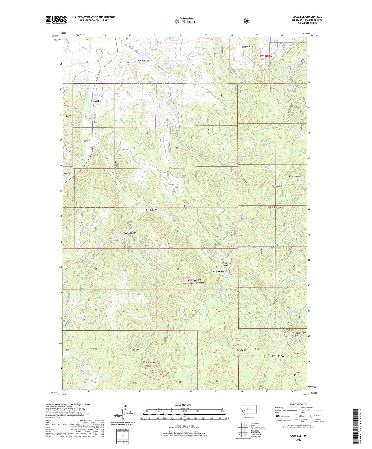
Maxville Montana US Topo Map
Couldn't load pickup availability
Also explore the Maxville Forest Service Topo of this same quad for updated USFS data
2024 topographic map quadrangle Maxville in the state of Montana. Scale: 1:24000. Based on the newly updated USGS 7.5' US Topo map series, this map is in the following counties: Granite. The map contains contour data, water features, and other items you are used to seeing on USGS maps, but also has updated roads and other features. This is the next generation of topographic maps. Printed on high-quality waterproof paper with UV fade-resistant inks.
Quads adjacent to this one:
West: Henderson Mountain
Northwest: Nirling Hill
North: Hall
Northeast: Dunkleberg Creek
East: Pikes Peak
Southeast: Pozega Lakes
South: Fred Burr Lake
Southwest: Philipsburg
This map covers the same area as the classic USGS quad with code o46113d2.
Contains the following named places: 08N13W04BAAB01 Well, 08N13W04BDAC01 Well, 08N13W04CAAA01 Well, 08N13W04CADA01 Well, 08N13W09BDBA01 Well, Achegan Mine, Boulder, Boulder Creek, Brooklyn Mine, Cominco Phosphate Mine, Copper Creek, Copper Creek Mine, Death Road Mine, Douglas Mountain, Fields, Flint School, Gird Creek Mine, Gold Hill Mine, Gold Reef, Ham Gulch, Ham Gulch Mine, Hickey Hill, Little Gold Creek, Londonderry Mine, Maxville, Maxville Census Designated Place, Maxville Post Office, Maywood Ridge, Medhurst Post Office, Middle Fork Douglas Creek, Moonlight Mine, Mount Princeton, NE Section 7 Mine, NE SW Section 17 Mine, New Seattle Mine, Nonpareil Mine, North Fork Douglas Creek, Pierre Hill, Princeton, Princeton Gulch, Princeton Mine, Princeton Placer Mine, Princeton Post Office, Princeton School, Royal Basin Mine, Royal Gold Creek, Saranac Mine, SE Section 12 Mine, Snow Cap Mine, Snowcap Mine, South Boulder Creek, South Fork Douglas Creek, SW Section 7 Mine, Swamp Gulch Creek, Travonia Mine, Wyman Gulch