MyTopo
Plains Montana US Topo Map
Couldn't load pickup availability
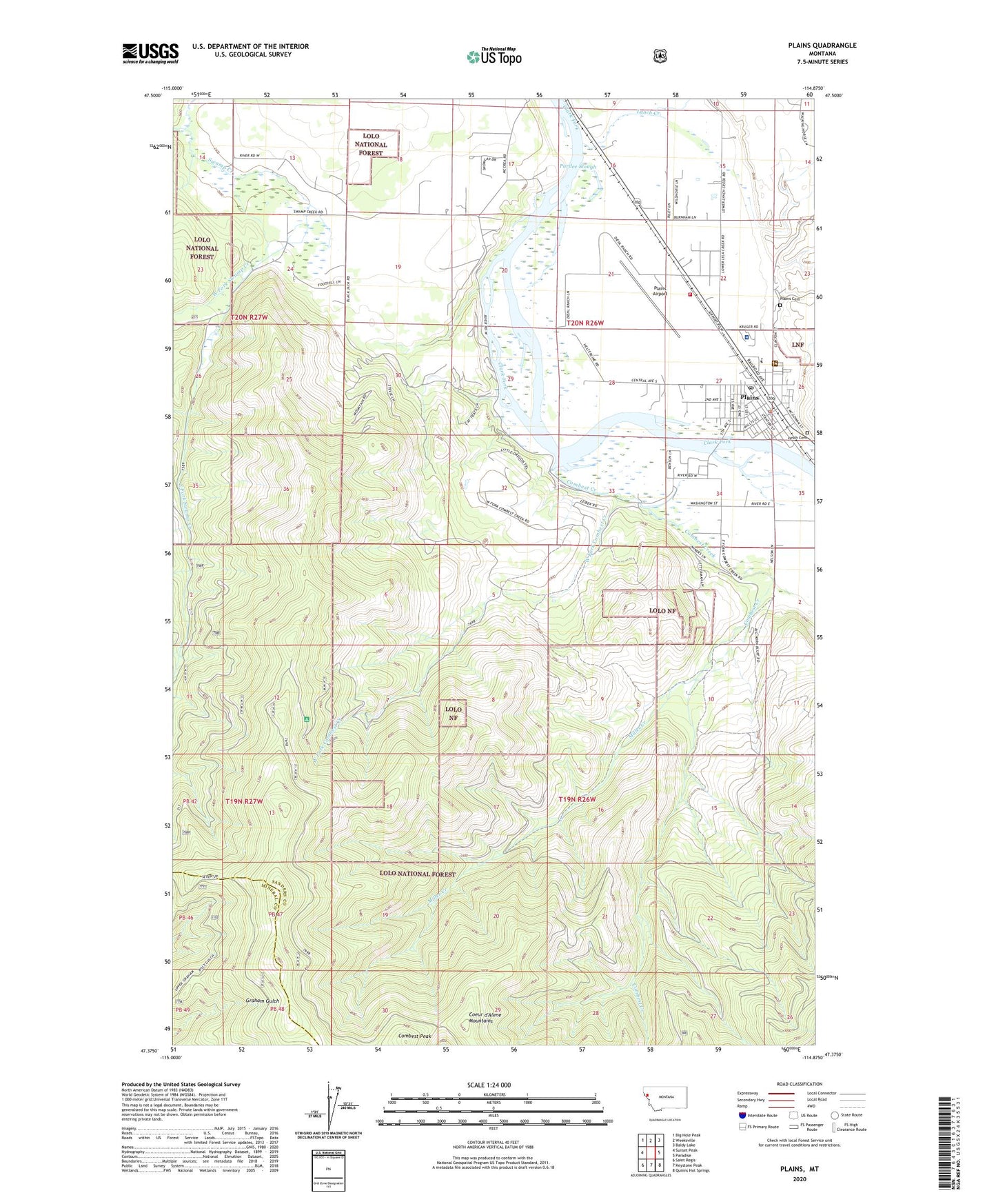
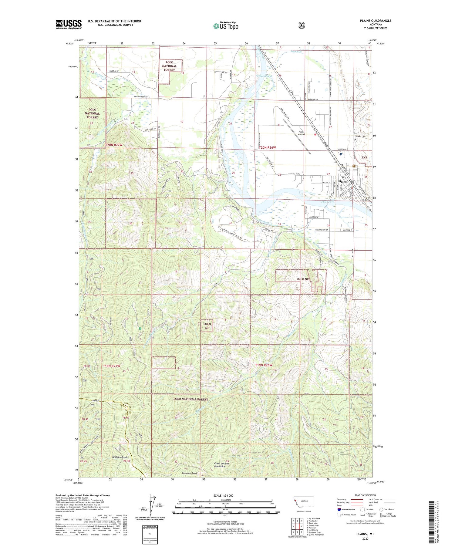
2020 topographic map quadrangle Plains in the state of Montana. Scale: 1:24000. Based on the newly updated USGS 7.5' US Topo map series, this map is in the following counties: Sanders, Mineral. The map contains contour data, water features, and other items you are used to seeing on USGS maps, but also has updated roads and other features. This is the next generation of topographic maps. Printed on high-quality waterproof paper with UV fade-resistant inks.
Quads adjacent to this one:
West: Sunset Peak
Northwest: Big Hole Peak
North: Weeksville
Northeast: Baldy Lake
East: Paradise
Southeast: Quinns Hot Springs
South: Keystone Peak
Southwest: Saint Regis
Contains the following named places: 19N26W03ACBC01 Well, 19N26W03BDAC01 Well, 20N26W15ACAB01 Well, 20N26W15BAAD01 Well, 20N26W16BADA01 Well, 20N26W23CCBA01 Well, 20N26W27DBBC01 Well, 20N26W27DDBC01 Well, 20N27W13DDCD01 Well, 20N27W24BDBC01 Well, Allen, Christian and Missionary Alliance Church, Clark Fork Baptist Church, Clark Fork Valley Clinic, Clark Fork Valley Hospital, Clark Fork Valley Hospital Heliport, Clark Fork Valley Nursing Home, Combest Creek, Combest Peak, Crossroads Motel and RV Park, East Fork Swamp Creek, First Lutheran Church, Lower Lettermen Mine, Lynch Cemetery, Lynch Creek, Miller Creek, Montro Gold Mine, Pardee Slough, Plains, Plains - Paradise Rural Fire District, Plains Airport, Plains Bible Chapel, Plains Cemetery, Plains Community Ambulance, Plains District Ranger Office, Plains Feed and Grain Elevator, Plains Golf Course, Plains Police Department, Plains Post Office, Plains Public Library, Plains Public Schools, Plains United Methodist Church, Plains Volunteer Fire Department, Rittenour Clinic, Saint James Catholic Church, Sanders County Fairgrounds, The Church of Jesus Christ of Latter Day Saints, Town of Plains, Upper Lettermen Mine, West Fork Combest Creek, West Fork Swamp Creek