MyTopo
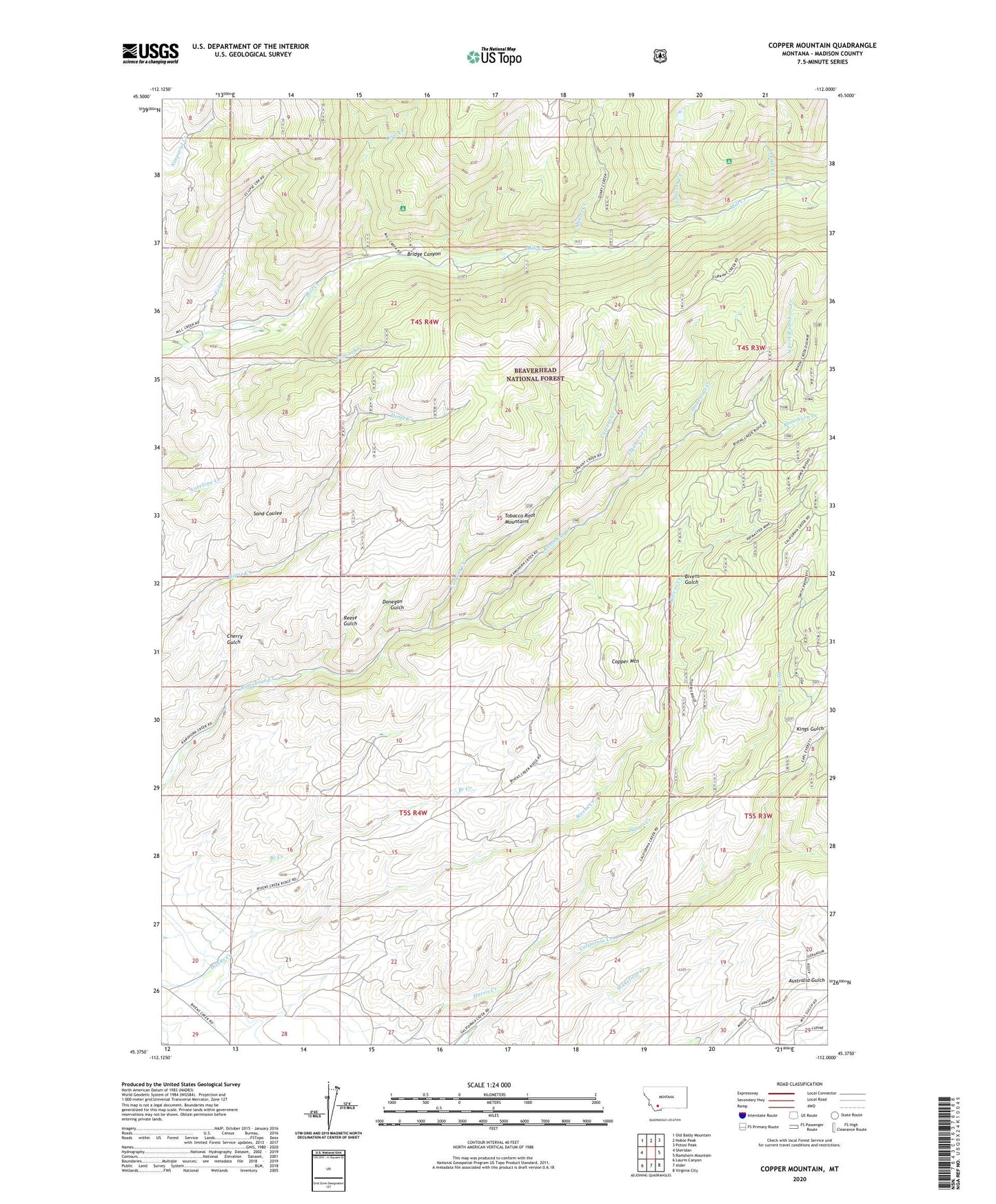
Copper Mountain Montana US Topo Map
Couldn't load pickup availability
Also explore the Copper Mountain Forest Service Topo of this same quad for updated USFS data
2024 topographic map quadrangle Copper Mountain in the state of Montana. Scale: 1:24000. Based on the newly updated USGS 7.5' US Topo map series, this map is in the following counties: Madison. The map contains contour data, water features, and other items you are used to seeing on USGS maps, but also has updated roads and other features. This is the next generation of topographic maps. Printed on high-quality waterproof paper with UV fade-resistant inks.
Quads adjacent to this one:
West: Sheridan
Northwest: Old Baldy Mountain
North: Noble Peak
Northeast: Potosi Peak
East: Ramshorn Mountain
Southeast: Virginia City
South: Alder
Southwest: Laurin Canyon
This map covers the same area as the classic USGS quad with code o45112d1.
Contains the following named places: 05S04W28BBAB01 Well, 05S04W28BBAB02 Well, 59749, Agitator/Concentrator Mine, Balanced Rock Campground, Betsy Baker Mine, Bridge Canyon, Cherry Gulch, Copper Mountain, Copper Mountain Mine, Cow Creek, Cow Creek Trail, Currant Creek, Currant Creek Trail, Donegan Gulch, East Fork Quartz Creek, Eclipse Creek, Freida Mine, Goldschmidt-Steiner Mine, Grandview Mine, Harris Creek Talc Mine, Horse Creek Quartz Mine, Hunts Claim Mine, J and J Mine, Jane and Nash Mine, Johnson Creek, Latest Out Mine, Leggat Creek, Mill Creek Campground, Nash Group Mine, NE NE Section 20 Mine, NE SW Section 30 Mine, Non Pareil Park, North Fork Antelope Creek Mine, North Fork Ramshorn Creek, NW NE Section 30 Mine, Paymaster Mine, Peacock Creek, Peacock Creek Trail, Pedro Mine, Pedro Trail, Pot Rustler Mine, Quartz Creek, Quartz Hill Trail, Reese Gulch, Sage Hen Mine, Sandstrom Mine, SE NW Section 36 Mine, SE SE Section 11 Mine, Silver Bar Mine, Silver Bullion Mine, Smuggler Mine, South Fork Mill Creek, Stonewall, Stonewall Creek, Studhorse Creek, SW NW Section 7 Mine, SW SW Section 12 Mine, Toledo Mine, Upper Pot Rustler Mine, Wakefield Creek, Wrights Mine