MyTopo
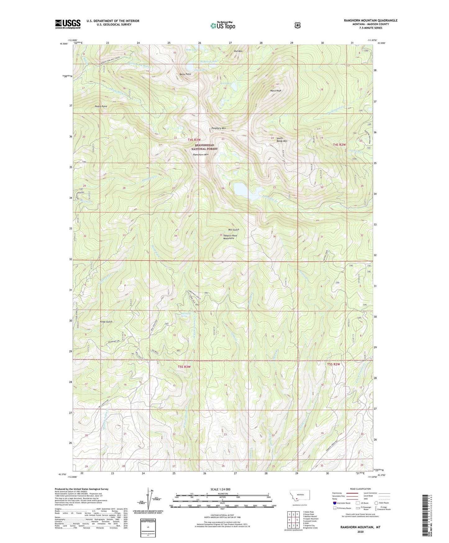
Ramshorn Mountain Montana US Topo Map
Couldn't load pickup availability
Also explore the Ramshorn Mountain Forest Service Topo of this same quad for updated USFS data
2024 topographic map quadrangle Ramshorn Mountain in the state of Montana. Scale: 1:24000. Based on the newly updated USGS 7.5' US Topo map series, this map is in the following counties: Madison. The map contains contour data, water features, and other items you are used to seeing on USGS maps, but also has updated roads and other features. This is the next generation of topographic maps. Printed on high-quality waterproof paper with UV fade-resistant inks.
Quads adjacent to this one:
West: Copper Mountain
Northwest: Noble Peak
North: Potosi Peak
Northeast: Maltbys Mound
East: Leonard Creek
Southeast: Eightmile Creek
South: Virginia City
Southwest: Alder
This map covers the same area as the classic USGS quad with code o45111d8.
Contains the following named places: B and L/First Chance Mine, Bald Number 12/Wildcat Mine, Beebe Fork, Belle Point, Bins Mine, Bins Mines, Cliff Lake, Downey Creek, Dulea Creek, Griffin Mill Mine, Kid Lake, Kid Mountain, Kings Gulch, Last Chance Mine, McKee Mine, McKelvey Lake, Mica Claims Mine, Middle Fork Mill Creek, Mill Gulch Spring, Mill Gulch Station, Mine Lake, Missouri Millsite, Missouri Mine, NE SW Section 27 Mine, Pedro Point, Porphyry Mountain, Ramshorn Mountain, SE NE Section 19 Mine, SE SE Section 25 Mine, Snowdrift Mine, Snowstorm Mine, South Baldy Mountain, South Fork Mill Creek Mine, South Meadow Creek Dam, South Meadow Creek Lake, Uncle Sam Mine, Ward Peak