MyTopo
Rimrock Divide Montana US Topo Map
Couldn't load pickup availability
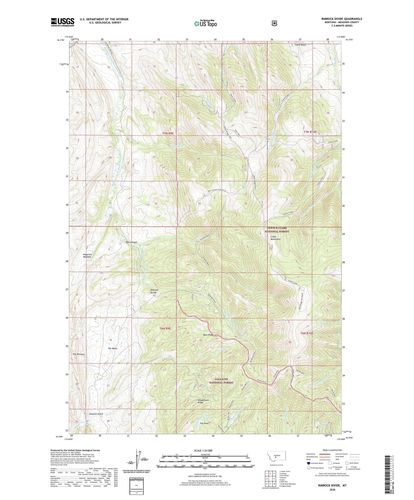
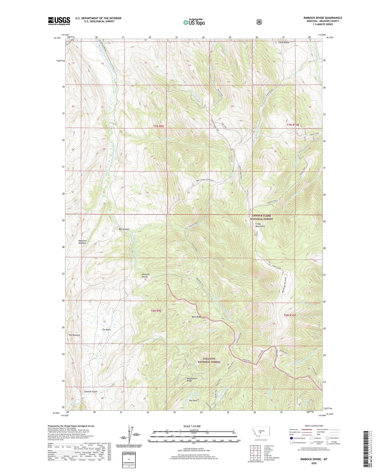
2020 topographic map quadrangle Rimrock Divide in the state of Montana. Scale: 1:24000. Based on the newly updated USGS 7.5' US Topo map series, this map is in the following counties: Meagher. The map contains contour data, water features, and other items you are used to seeing on USGS maps, but also has updated roads and other features. This is the next generation of topographic maps. Printed on high-quality waterproof paper with UV fade-resistant inks.
Quads adjacent to this one:
West: Hamen
Northwest: Castle Town
North: Lennep
Northeast: Groveland
East: Lebo
Southeast: Virginia Peak
South: Scab Rock Mountain
Southwest: Wolf Hill
Contains the following named places: 06N13E01CDCB01 Well, Bald Ridge, Bill Bracket Place, Box Canyon, Glenns Cabin, Haypress Meadow, Hereim Homestead, Hoyem Homestead, Indian Creek, Little Cottonwood Creek, McKee Homestead, Pig Creek, Rimrock Divide, Rostad Ranch, Sawmill Gulch, Spruce Springs, The Basin, The Park, The Reefs, The Rimrock, Woodchuck Ridge