MyTopo
Rocking Chair Butte Montana US Topo Map
Couldn't load pickup availability
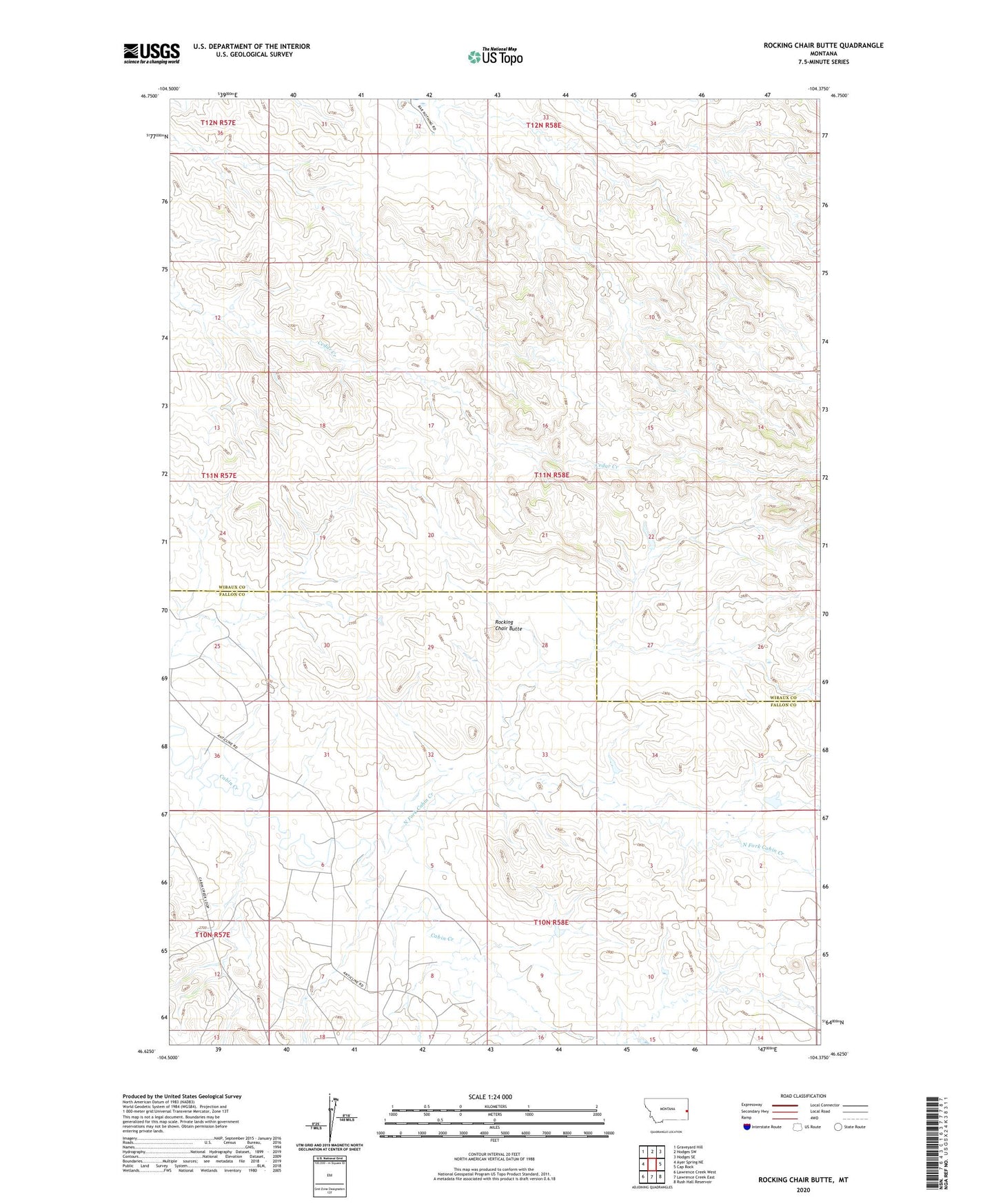
2024 topographic map quadrangle Rocking Chair Butte in the state of Montana. Scale: 1:24000. Based on the newly updated USGS 7.5' US Topo map series, this map is in the following counties: Wibaux, Fallon. The map contains contour data, water features, and other items you are used to seeing on USGS maps, but also has updated roads and other features. This is the next generation of topographic maps. Printed on high-quality waterproof paper with UV fade-resistant inks.
Quads adjacent to this one:
West: Ayer Spring NE
Northwest: Graveyard Hill
North: Hodges SW
Northeast: Hodges SE
East: Cap Rock
Southeast: Rush Hall Reservoir
South: Lawrence Creek East
Southwest: Lawrence Creek West
This map covers the same area as the classic USGS quad with code o46104f4.
Contains the following named places: North Fork Cabin Creek, Rocking Chair Butte, Wills Creek Post Office