MyTopo
Rosebud Buttes Montana US Topo Map
Couldn't load pickup availability
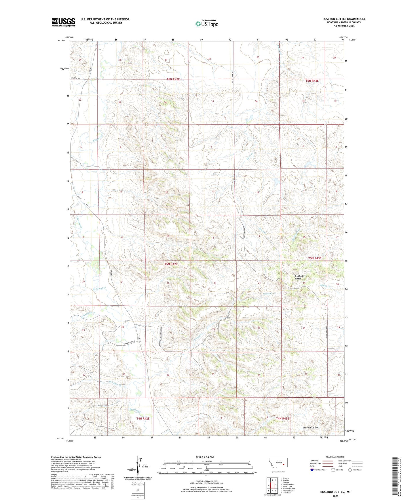
2024 topographic map quadrangle Rosebud Buttes in the state of Montana. Scale: 1:24000. Based on the newly updated USGS 7.5' US Topo map series, this map is in the following counties: Rosebud. The map contains contour data, water features, and other items you are used to seeing on USGS maps, but also has updated roads and other features. This is the next generation of topographic maps. Printed on high-quality waterproof paper with UV fade-resistant inks.
Quads adjacent to this one:
West: Smith Creek NE
Northwest: Orinoco
North: Rosebud
Northeast: Thurlow
East: Indian Creek
Southeast: Crain Place
South: Mitchell Coulee
Southwest: McKerlich Creek
This map covers the same area as the classic USGS quad with code o46106b4.
Contains the following named places: 05N42E09CCBC01 Well, 05N42E12BBBD01 Well, 06N42E28BCAC01 Well, 06N42E32DCBD01 Well, KIKC-FM (Forsyth), Langohr Number 1 Dam, Montana Number 9 Dam, Peterson Reservoir Dam, Pleasant Hill School, Rosebud Buttes, Vance Creek, West Rosebud Creek, West Vance Creek