MyTopo
Sandpiper Reservoir Montana US Topo Map
Couldn't load pickup availability
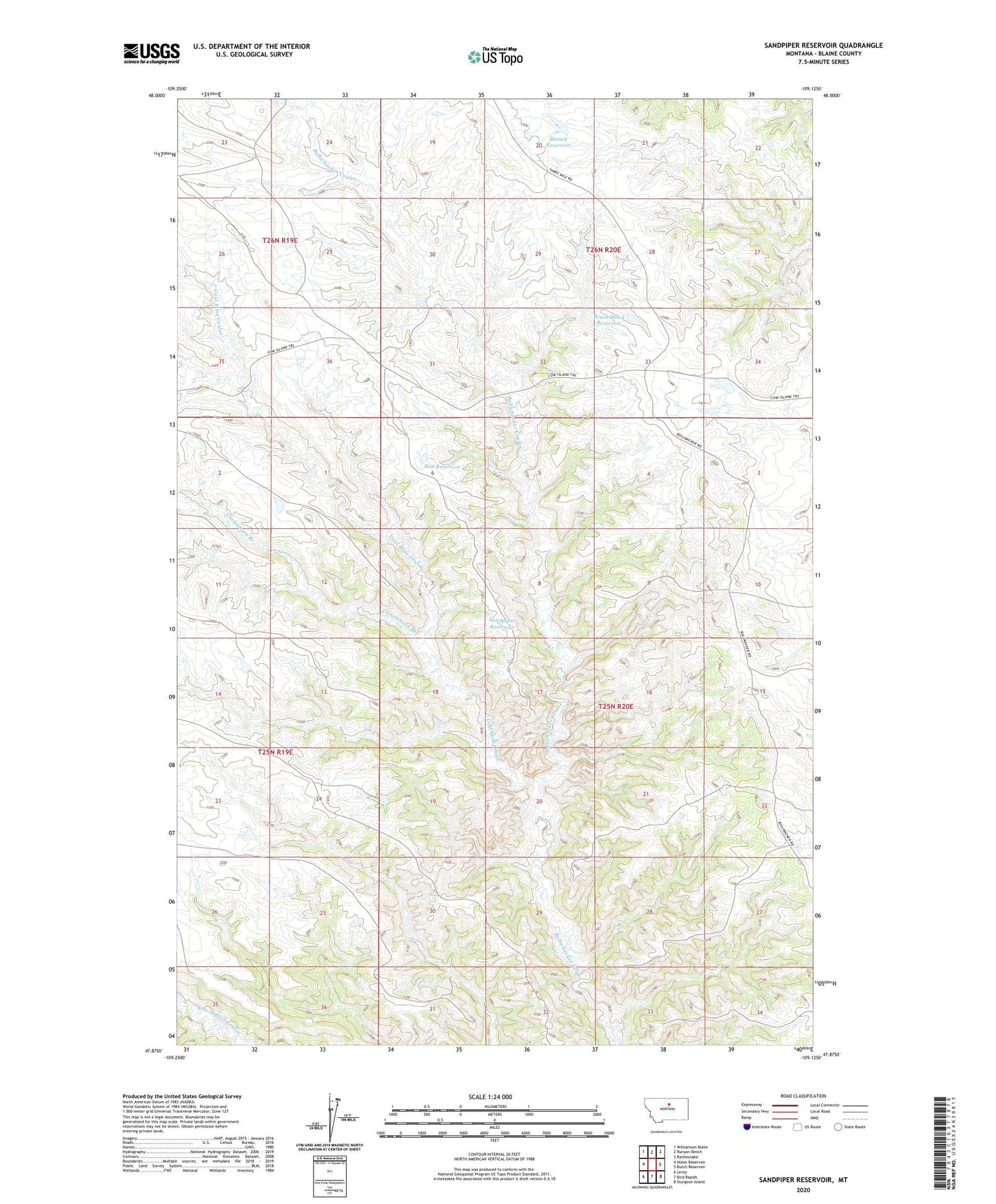
2024 topographic map quadrangle Sandpiper Reservoir in the state of Montana. Scale: 1:24000. Based on the newly updated USGS 7.5' US Topo map series, this map is in the following counties: Blaine. The map contains contour data, water features, and other items you are used to seeing on USGS maps, but also has updated roads and other features. This is the next generation of topographic maps. Printed on high-quality waterproof paper with UV fade-resistant inks.
Quads adjacent to this one:
West: Nolan Reservoir
Northwest: Williamson Butte
North: Runyan Bench
Northeast: Rattlesnake
East: Butch Reservoir
Southeast: Sturgeon Island
South: Bird Rapids
Southwest: Leroy
This map covers the same area as the classic USGS quad with code o47109h2.
Contains the following named places: 25N20E33BCBC01 Well, Blanch Reservoir, Brush Shack Reservoir, Bud Reservoir, Christenson Branch, Coal Mine Coulee, Cow Island Trail, Sandpiper Reservoir