MyTopo
Shawmut Montana US Topo Map
Couldn't load pickup availability
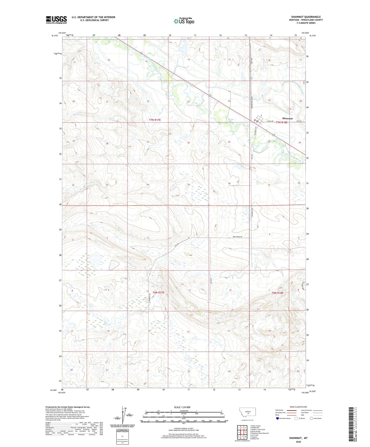
2024 topographic map quadrangle Shawmut in the state of Montana. Scale: 1:24000. Based on the newly updated USGS 7.5' US Topo map series, this map is in the following counties: Wheatland. The map contains contour data, water features, and other items you are used to seeing on USGS maps, but also has updated roads and other features. This is the next generation of topographic maps. Printed on high-quality waterproof paper with UV fade-resistant inks.
Quads adjacent to this one:
West: Devils Pocket
Northwest: Ethels Coulee
North: Hedgesville
Northeast: Halbert Creek South
East: Deadmans Basin Reservoir
South: Progress
Southwest: Jim Creek
This map covers the same area as the classic USGS quad with code o46109c5.
Contains the following named places: 06N17E02CBA_01 Well, 07N17E24DD__01 Well, 07N17E25____01 Well, 07N18E19____01 Well, 59078, Berg Dam, Blessed Sacrament Mission, Cinnamon Number 6 Dam, Deadmans Basin Dike, Deadmans Basin Supply Canal, Shawmut, Shawmut Census Designated Place, Shawmut Post Office, Shawmut School, United Methodist Church, Wheatland County Fire Department