MyTopo
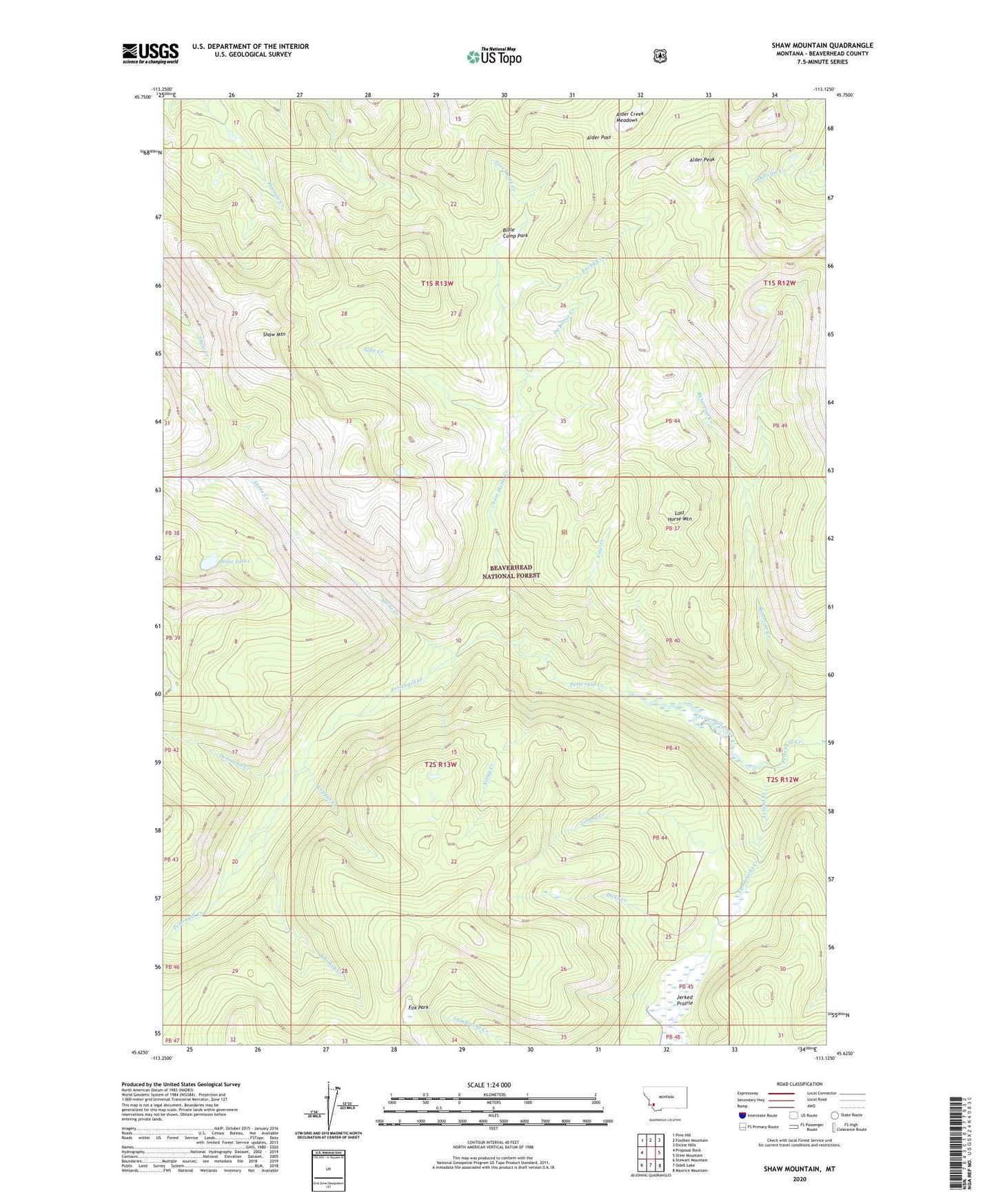
Shaw Mountain Montana US Topo Map
Couldn't load pickup availability
Also explore the Shaw Mountain Forest Service Topo of this same quad for updated USFS data
2024 topographic map quadrangle Shaw Mountain in the state of Montana. Scale: 1:24000. Based on the newly updated USGS 7.5' US Topo map series, this map is in the following counties: Beaverhead. The map contains contour data, water features, and other items you are used to seeing on USGS maps, but also has updated roads and other features. This is the next generation of topographic maps. Printed on high-quality waterproof paper with UV fade-resistant inks.
Quads adjacent to this one:
West: Proposal Rock
Northwest: Pine Hill
North: Foolhen Mountain
Northeast: Dickie Hills
East: Stine Mountain
Southeast: Maurice Mountain
South: Odell Lake
Southwest: Stewart Mountain
This map covers the same area as the classic USGS quad with code o45113f2.
Contains the following named places: Alder Creek Meadows, Alder Creek Trail, Alder Pass, Alder Peak, Bible Camp Park, Copper Creek, Copper Creek Trail, Cow Creek, De Boose Creek, Demijohn Creek, Dicks Creek, Effie Creek, Fox Park, Hiline Trail, Jerked Prairie, Kelley Cabin, Kelley Creek, Lost Horse Creek, Lost Horse Mountain, Reservoir Creek, Rocky Creek, Shaw Mountain, Stone Creek, Toland Creek, Whiskey Creek