
MyTopo
Todd Lakes SE Montana US Topo Map
Couldn't load pickup availability
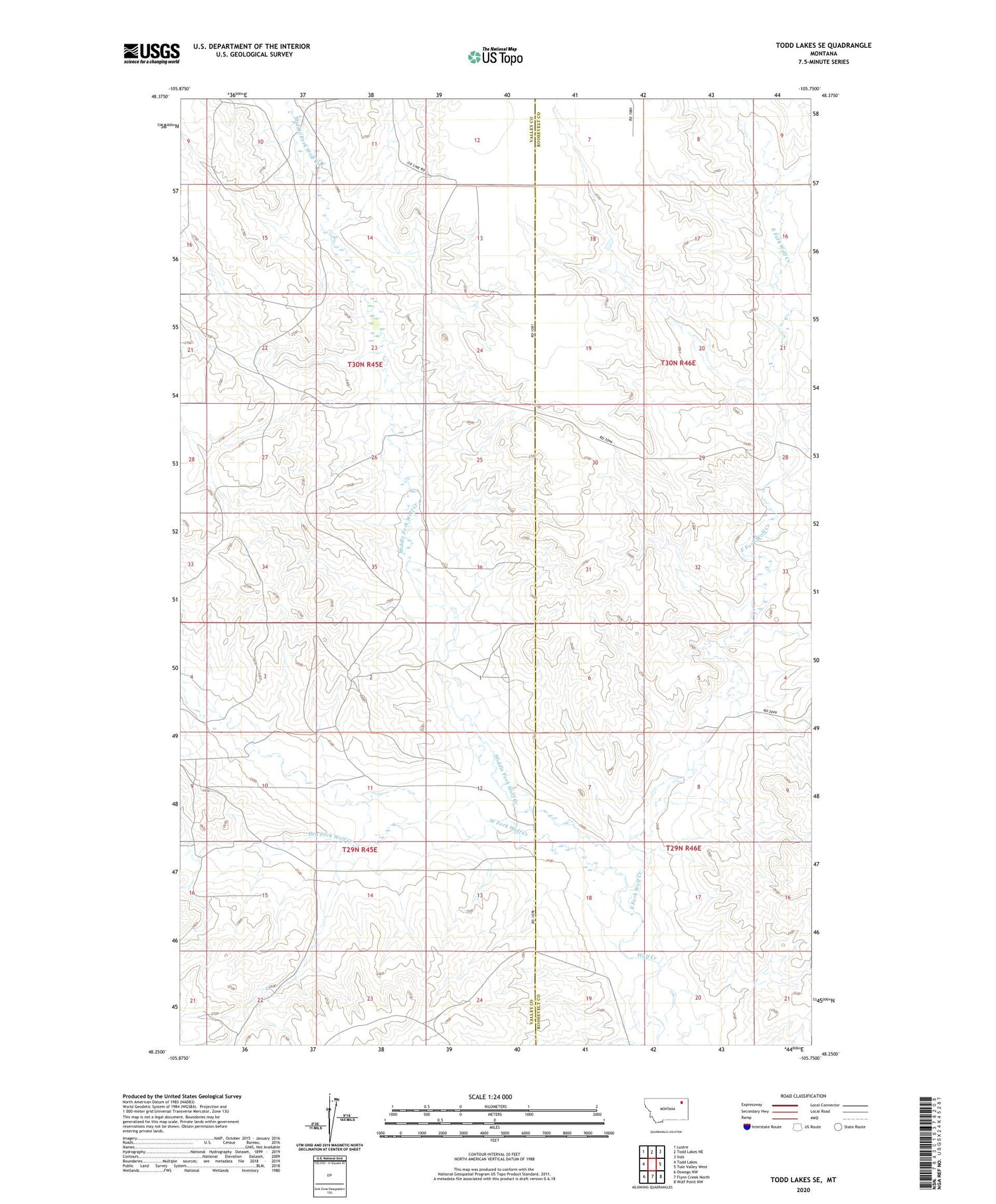
2020 topographic map quadrangle Todd Lakes SE in the state of Montana. Scale: 1:24000. Based on the newly updated USGS 7.5' US Topo map series, this map is in the following counties: Valley, Roosevelt. The map contains contour data, water features, and other items you are used to seeing on USGS maps, but also has updated roads and other features. This is the next generation of topographic maps. Printed on high-quality waterproof paper with UV fade-resistant inks.
Quads adjacent to this one:
West: Todd Lakes
Northwest: Lustre
North: Todd Lakes NE
Northeast: Volt
East: Tule Valley West
Southeast: Wolf Point NW
South: Flynn Creek North
Southwest: Oswego NW
Contains the following named places: 29N45E15CDBA01 Well, 29N45E23CADA01 Well, 29N46E05DCCD01 Well, 29N46E08ABBB01 Well, 29N46E08ABBD01 Well, 30N45E24AD__01 Well, 30N45E25BAAC01 Well, 30N45E25BADA01 Well, Dry Fork Wolf Creek, East Fork Wolf Creek, Middle Fork Wolf Creek, Roosevelt School, West Fork Wolf Creek


