MyTopo
Wolf Point NW Montana US Topo Map
Couldn't load pickup availability
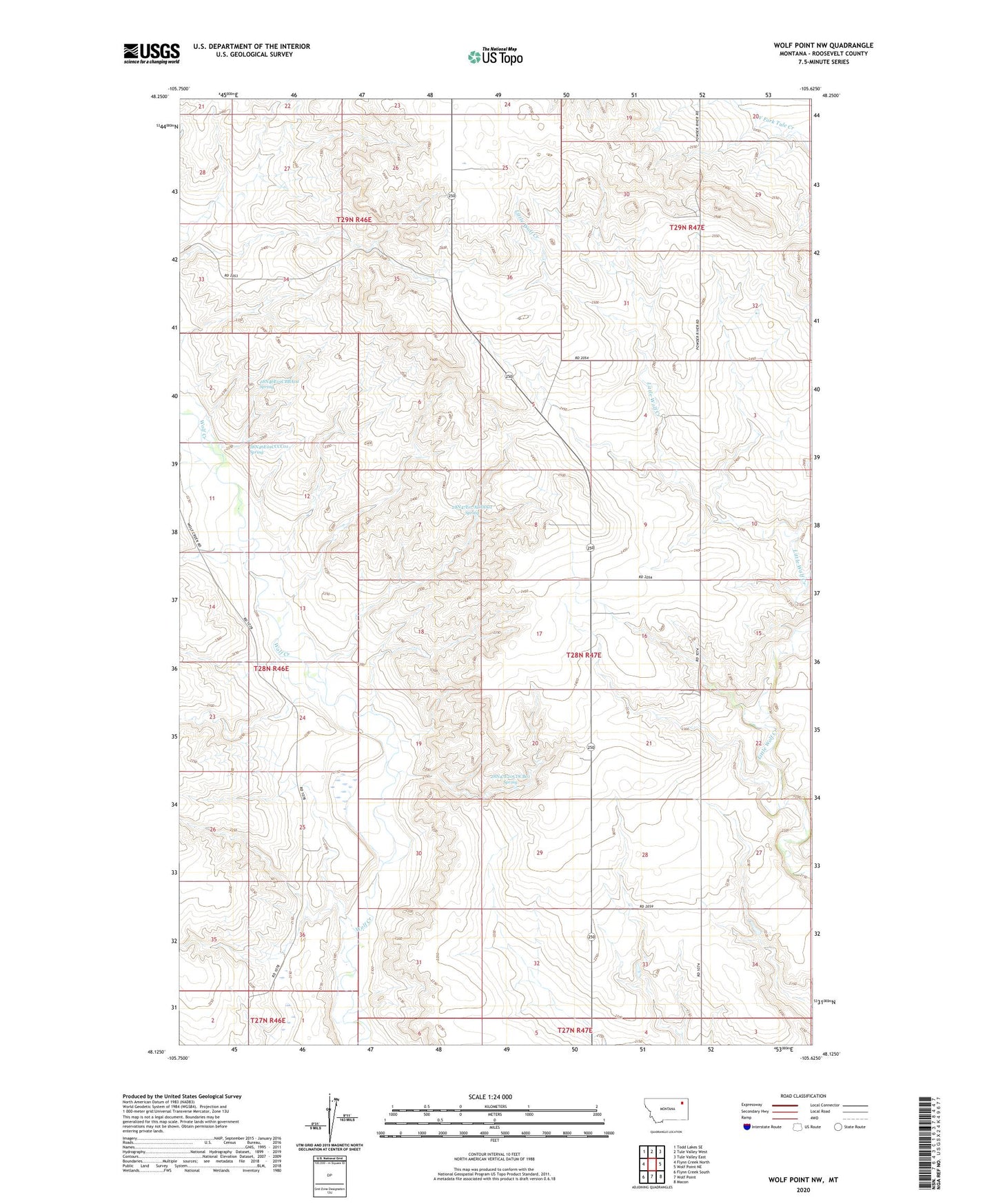
2024 topographic map quadrangle Wolf Point NW in the state of Montana. Scale: 1:24000. Based on the newly updated USGS 7.5' US Topo map series, this map is in the following counties: Roosevelt. The map contains contour data, water features, and other items you are used to seeing on USGS maps, but also has updated roads and other features. This is the next generation of topographic maps. Printed on high-quality waterproof paper with UV fade-resistant inks.
Quads adjacent to this one:
West: Flynn Creek North
Northwest: Todd Lakes SE
North: Tule Valley West
Northeast: Tule Valley East
East: Wolf Point NE
Southeast: Macon
South: Wolf Point
Southwest: Flynn Creek South
This map covers the same area as the classic USGS quad with code o48105b6.
Contains the following named places: 28N46E01CBBA02 Spring, 28N46E01CCCC01 Spring, 28N46E11DDCC01 Well, 28N46E12BDAA01 Well, 28N47E07ADDD01 Spring, 28N47E16BDAB01 Well, 28N47E20CDCB01 Spring, 28N47E20DADB01 Well, 28N47E20DADB02 Well, 28N47E28ABBB01 Well, 28N47E33CBCA01 Well, 29N46E28ABAA01 Well, 29N46E34DBDA01 Well, 29N47E29BBCA01 Well, 29N47E29CCCA02 Well, 29N47E30DBBB01 Well, 29N47E31DBBD01 Well, 29N47E32BCAC01 Well, 59201, Anderson School, KTYZ-FM (Wolf Point), Long View School, Star School