MyTopo
Upper Tepee Basin Montana US Topo Map
Couldn't load pickup availability
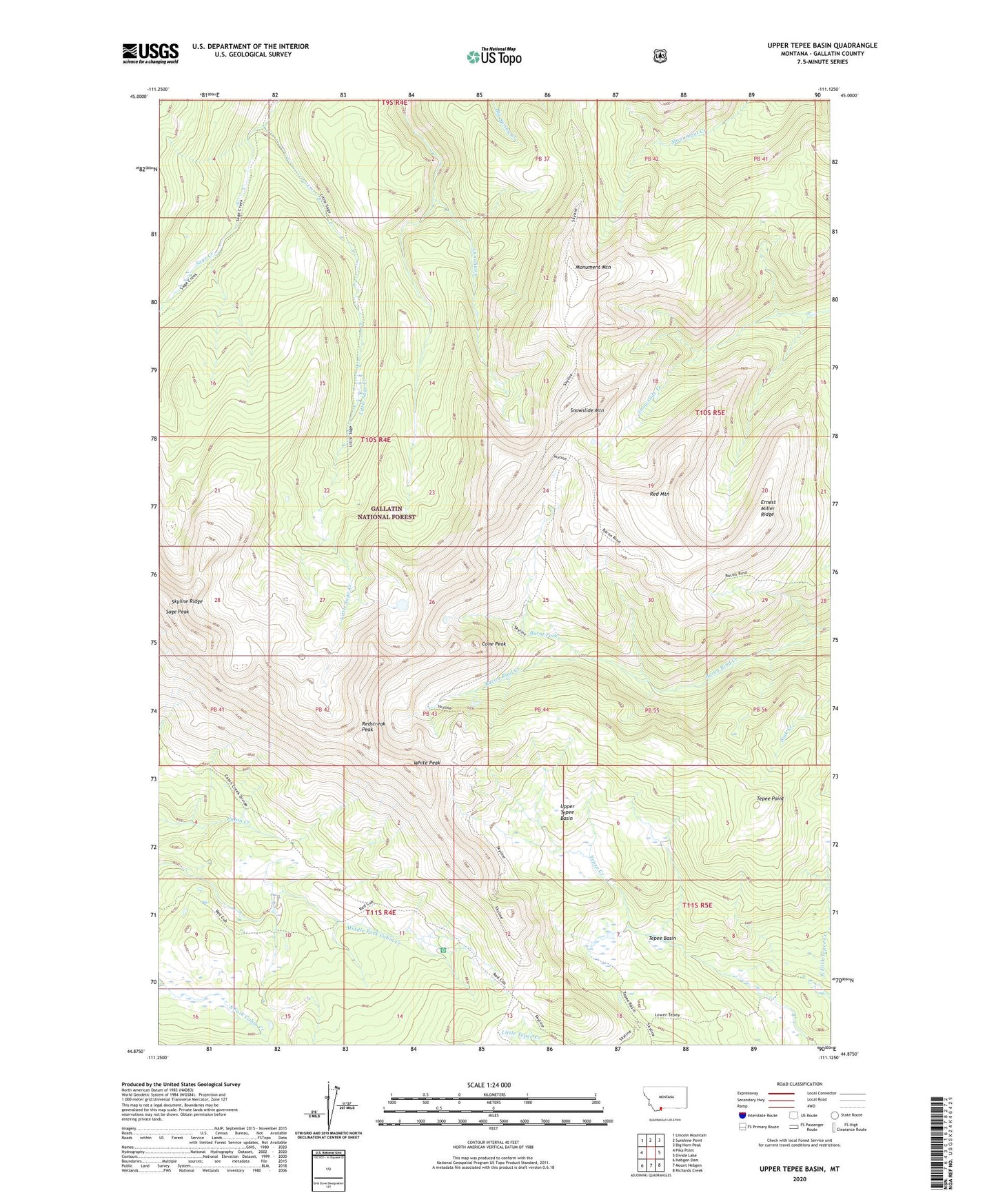
2020 topographic map quadrangle Upper Tepee Basin in the state of Montana. Scale: 1:24000. Based on the newly updated USGS 7.5' US Topo map series, this map is in the following counties: Gallatin. The map contains contour data, water features, and other items you are used to seeing on USGS maps, but also has updated roads and other features. This is the next generation of topographic maps. Printed on high-quality waterproof paper with UV fade-resistant inks.
Quads adjacent to this one:
West: Pika Point
Northwest: Lincoln Mountain
North: Sunshine Point
Northeast: Big Horn Peak
East: Divide Lake
Southeast: Richards Creek
South: Mount Hebgen
Southwest: Hebgen Dam
Contains the following named places: Burnt Fork, Cabin Creek Divide Trail, Cabin Creek Ranger Station, Cabin Creek Wildlife Management Area, Cone Peak, Ernest Miller Ridge, Lee Metcalf Wilderness (Monument Mountain Unit), Little Sage Creek, Monument Mountain, Red Mountain, Redstreak Peak, Sage Peak, Skyline Ridge, Skyline Trail, Snowslide Mountain, Tepee Basin, Tepee Point, Upper Tepee Basin, White Peak