MyTopo
Varney Montana US Topo Map
Couldn't load pickup availability
Also explore the Varney Forest Service Topo of this same quad for updated USFS data
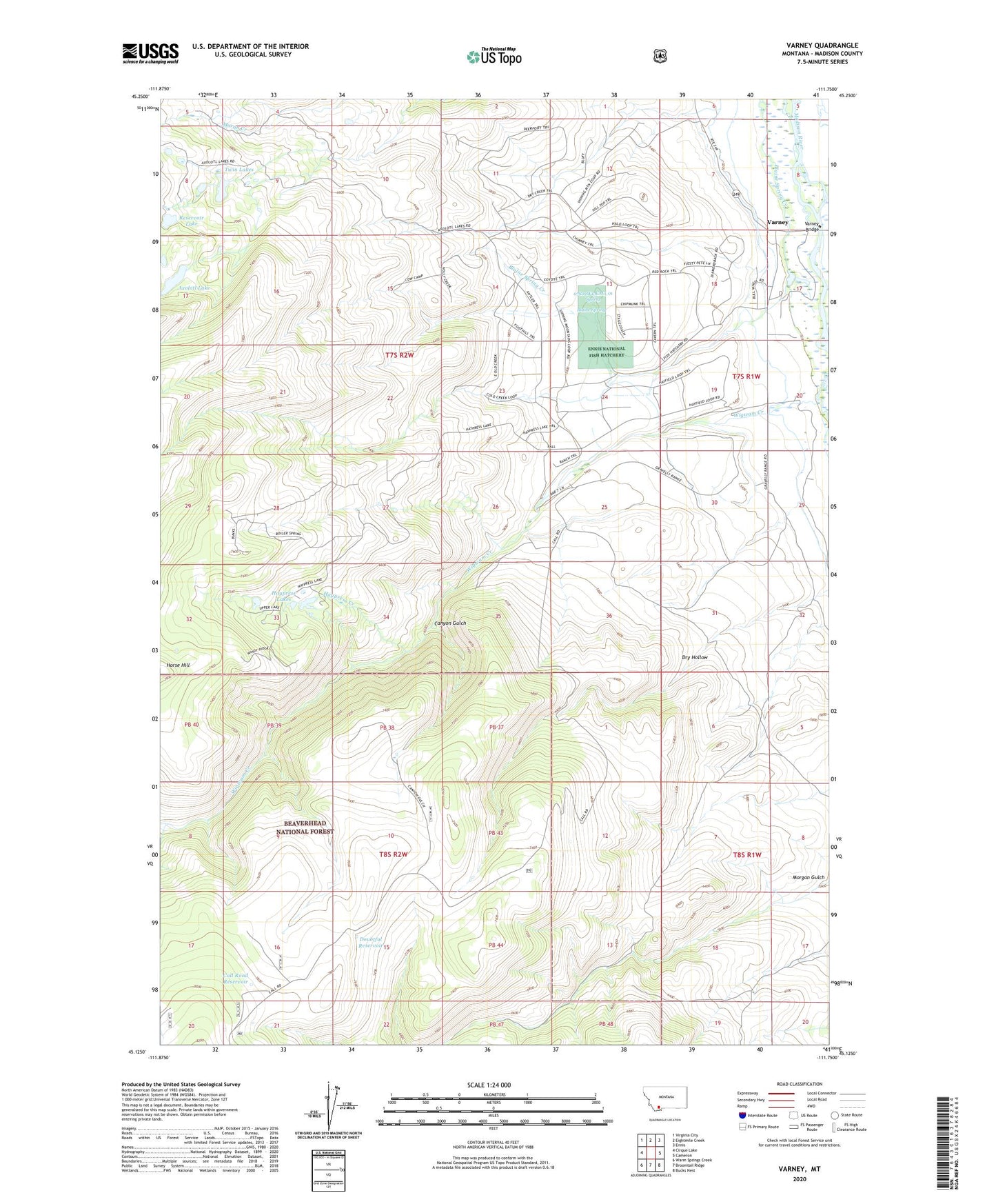
2024 topographic map quadrangle Varney in the state of Montana. Scale: 1:24000. Based on the newly updated USGS 7.5' US Topo map series, this map is in the following counties: Madison. The map contains contour data, water features, and other items you are used to seeing on USGS maps, but also has updated roads and other features. This is the next generation of topographic maps. Printed on high-quality waterproof paper with UV fade-resistant inks.
Quads adjacent to this one:
West: Cirque Lake
Northwest: Virginia City
North: Eightmile Creek
Northeast: Ennis
East: Cameron
Southeast: Bucks Nest
South: Broomtail Ridge
Southwest: Warm Springs Creek
This map covers the same area as the classic USGS quad with code o45111b7.
Contains the following named places: 07S01W07DBCD01 Well, 07S01W17BBBB01 Well, 07S01W17BCBD01 Well, 07S01W18DDAC01 Well, 07S01W20CBAA01 Well, 07S02W13CAC_01 Spring, 07S02W24CCBD01 Well, Axolotl Lake, Axolotl Lakes, Blaine Spring, Call Road Reservoir, Canyon Gulch, Crockett Lake Ranger Station, Doubtful Reservoir, Dry Hollow, East Axolotl Lake Dam, Ennis Cultural Station, Ennis National Fish Hatchery, Foster Ranch, Gerard Ranch, Haypress Creek, Haypress Lakes, Heart Lake, Kent Ranch, Rankin Ranch, Reservoir Lake, Twin Lakes, Varney, Varney Bridge, Varney Bridge Fishing Access Site, Varney Post Office, Varney School, Wigwam Creek, Woodward Place