MyTopo
Columbus East Montana US Topo Map
Couldn't load pickup availability
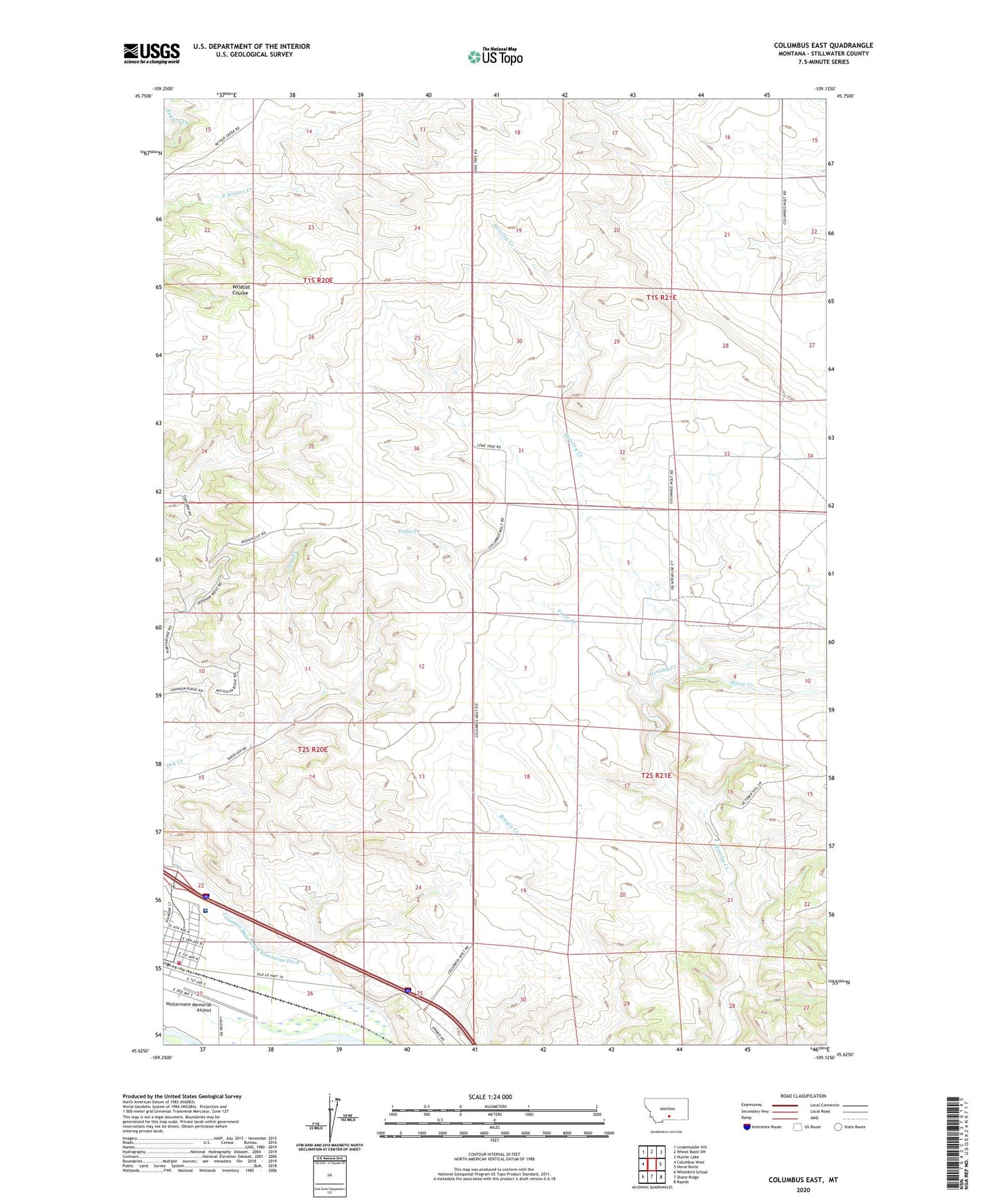
2024 topographic map quadrangle Columbus East in the state of Montana. Scale: 1:24000. Based on the newly updated USGS 7.5' US Topo map series, this map is in the following counties: Stillwater. The map contains contour data, water features, and other items you are used to seeing on USGS maps, but also has updated roads and other features. This is the next generation of topographic maps. Printed on high-quality waterproof paper with UV fade-resistant inks.
Quads adjacent to this one:
West: Columbus West
Northwest: Lindemulder Hill
North: Wheat Basin SW
Northeast: Hunter Lake
East: Horse Butte
Southeast: Rapids
South: Shane Ridge
Southwest: Whitebird School
This map covers the same area as the classic USGS quad with code o45109f2.
Contains the following named places: Carr Trailer Court, Columbus Rural Fire Department, Columbus Volunteer Fire Department, Horse Creek, Itch-Kep-Pe Park, Itch-Kep-Pe Park Campground, New Life Victory Center, Stillwater Billings Clinic, Stillwater Golf Course, Toms Creek, Town of Columbus, Woltermann Memorial Airport, ZIP Code: 59019