MyTopo
Shane Ridge Montana US Topo Map
Couldn't load pickup availability
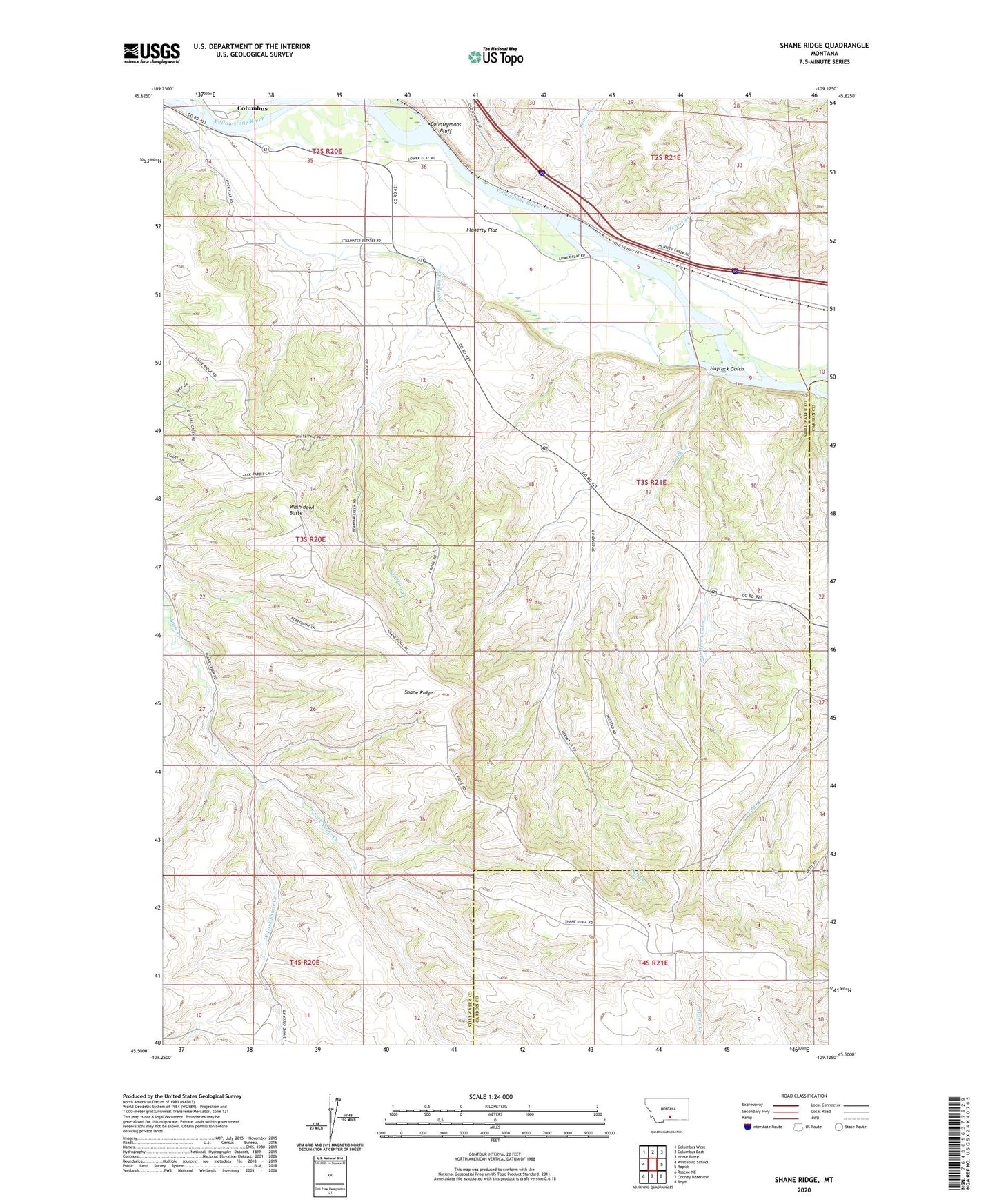
2024 topographic map quadrangle Shane Ridge in the state of Montana. Scale: 1:24000. Based on the newly updated USGS 7.5' US Topo map series, this map is in the following counties: Stillwater, Carbon. The map contains contour data, water features, and other items you are used to seeing on USGS maps, but also has updated roads and other features. This is the next generation of topographic maps. Printed on high-quality waterproof paper with UV fade-resistant inks.
Quads adjacent to this one:
West: Whitebird School
Northwest: Columbus West
North: Columbus East
Northeast: Horse Butte
East: Rapids
Southeast: Boyd
South: Cooney Reservoir
Southwest: Roscoe NE
This map covers the same area as the classic USGS quad with code o45109e2.
Contains the following named places: 03S20E01BCAD01 Well, 03S20E27ABDD01 Well, 03S21E31CDDD01 Well, Bearpaw Creek, Brown Creek, Coal Mine Coulee, Countrymans Bluff, East Fork Shane Creek, Flaherty Flat, Hayrack Gulch, Hensley Creek, Misko, Shane Creek School, Shane Ridge, Shane Ridge School, Standard School, Tutt Creek, Tutt Creek School, Wash Bowl Butte, West Fork Shane Creek