MyTopo
Cooney Reservoir Montana US Topo Map
Couldn't load pickup availability
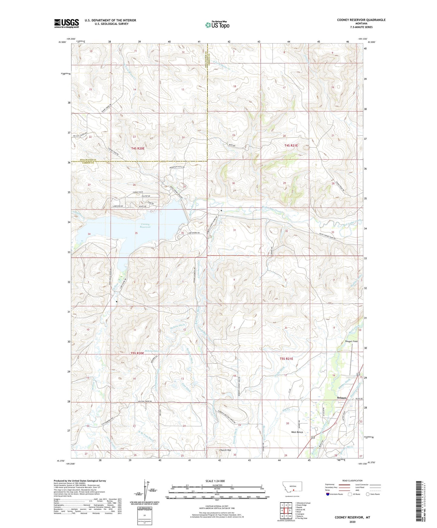
2024 topographic map quadrangle Cooney Reservoir in the state of Montana. Scale: 1:24000. Based on the newly updated USGS 7.5' US Topo map series, this map is in the following counties: Carbon, Stillwater. The map contains contour data, water features, and other items you are used to seeing on USGS maps, but also has updated roads and other features. This is the next generation of topographic maps. Printed on high-quality waterproof paper with UV fade-resistant inks.
Quads adjacent to this one:
West: Roscoe NE
Northwest: Whitebird School
North: Shane Ridge
Northeast: Rapids
East: Boyd
Southeast: The Big Slide
South: Roberts
Southwest: Castagne
This map covers the same area as the classic USGS quad with code o45109d2.
Contains the following named places: 04S20E26CDDC01 Well, 04S20E36BBBB01 Well, 05S21E05BDDC01 Well, 59070, Bangart Field, Bertoline Number 1 Dam, Chapman Creek, Church Hill, Clear Creek, Cook Ditch, Cooney Campground, Cooney Dam, Cooney Reservoir, Cooney Reservoir State Park, Cottonwood Coulee, Cottonwood Creek, Dry Creek, Finn Ditch, Hokola Ditch, Hycke Ditch, Karvonen Ditch, Korpola Ditch, Long Coulee, North Willow Creek School, Roberts Rest Area, Saarela Ditch, Selmes, Shorey Ditch, Sunny Nook School, Upper Cottonwood School, West Branch Finn Ditch, Willow Creek, Wilson School