MyTopo
Stine Mountain Montana US Topo Map
Couldn't load pickup availability
Also explore the Stine Mountain Forest Service Topo of this same quad for updated USFS data
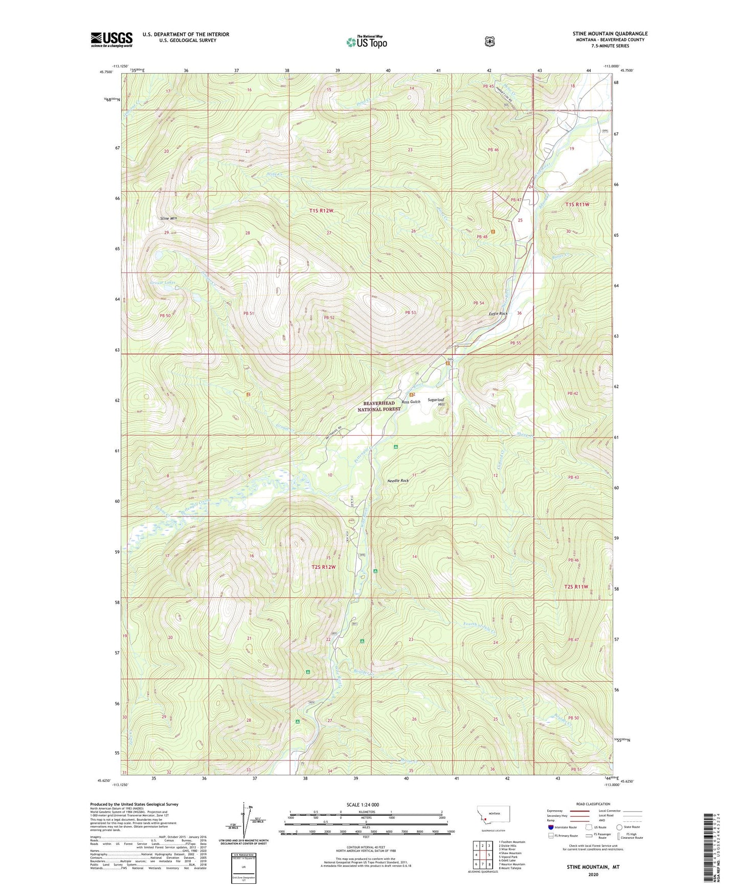
2024 topographic map quadrangle Stine Mountain in the state of Montana. Scale: 1:24000. Based on the newly updated USGS 7.5' US Topo map series, this map is in the following counties: Beaverhead. The map contains contour data, water features, and other items you are used to seeing on USGS maps, but also has updated roads and other features. This is the next generation of topographic maps. Printed on high-quality waterproof paper with UV fade-resistant inks.
Quads adjacent to this one:
West: Shaw Mountain
Northwest: Foolhen Mountain
North: Dickie Hills
Northeast: Wise River
East: Vipond Park
Southeast: Mount Tahepia
South: Maurice Mountain
Southwest: Odell Lake
This map covers the same area as the classic USGS quad with code o45113f1.
Contains the following named places: Adson Creek, Atlas Mine, Boulder Campground, Boulder Creek, Butler Creek, Clifford Creek, Deno Creek, Eagle Rock, Evans Creek, Flying Cloud Ranch, Fourth of July Campground, Fourth of July Creek, Grouse Creek, Grouse Lakes, Lews Creek, Lodgepole Campground, Moose Creek, Needle Rock, Pettengill Creek, Ponsonby Post Office, Ross, Ross Gulch, Sheep Creek, Stine Creek, Stine Creek Trail, Stine Mountain, Sugarloaf Hill, Willow Campground, Wise River Ditch