MyTopo
Buffalo Creek SE Montana US Topo Map
Couldn't load pickup availability
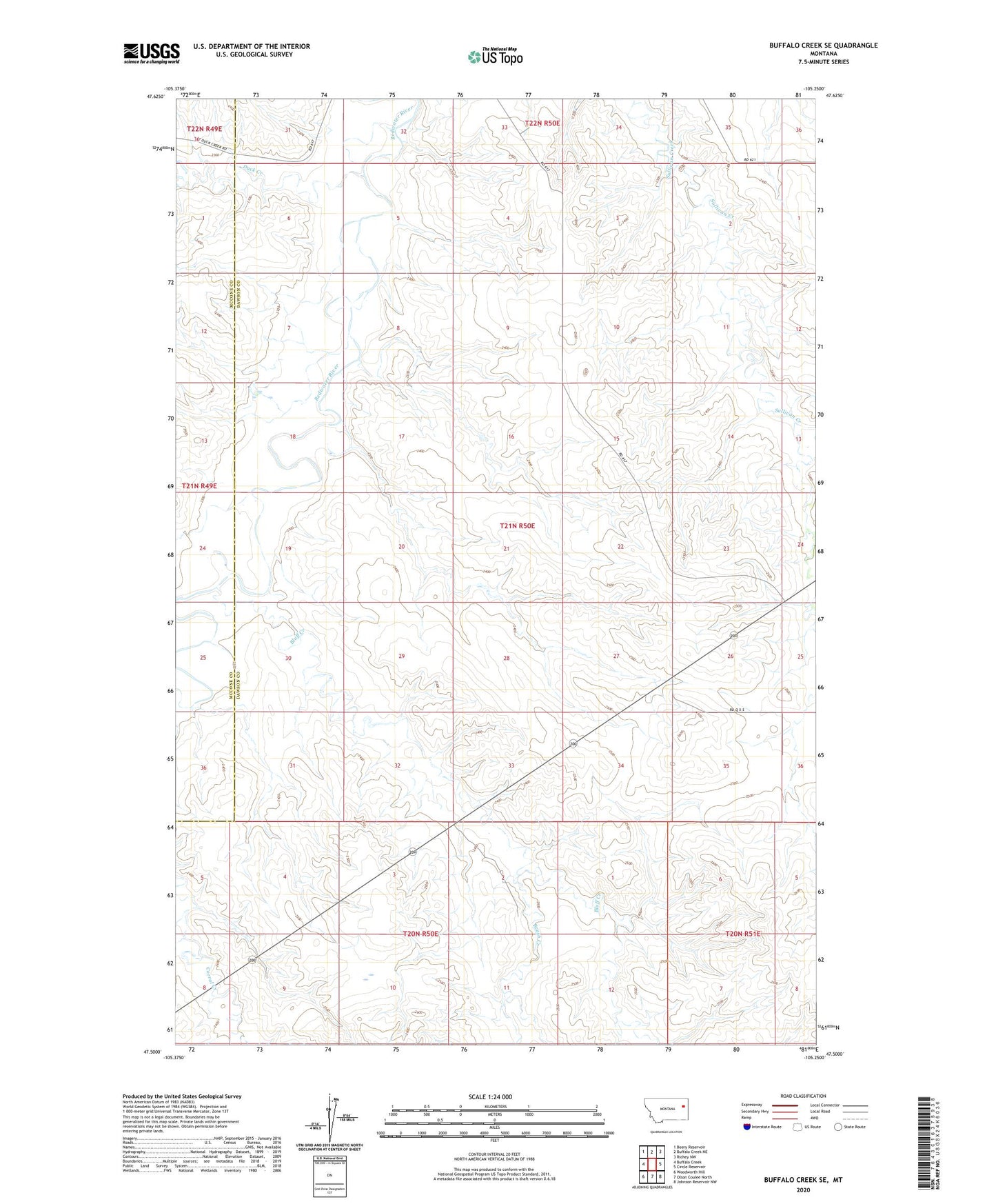
2024 topographic map quadrangle Buffalo Creek SE in the state of Montana. Scale: 1:24000. Based on the newly updated USGS 7.5' US Topo map series, this map is in the following counties: Dawson, McCone. The map contains contour data, water features, and other items you are used to seeing on USGS maps, but also has updated roads and other features. This is the next generation of topographic maps. Printed on high-quality waterproof paper with UV fade-resistant inks.
Quads adjacent to this one:
West: Buffalo Creek
Northwest: Beery Reservoir
North: Buffalo Creek NE
Northeast: Richey NW
East: Circle Reservoir
Southeast: Johnson Reservoir NW
South: Olson Coulee North
Southwest: Woodworth Hill
This map covers the same area as the classic USGS quad with code o47105e3.
Contains the following named places: 20N50E11ACCC01 Well, 20N50E12BABA01 Well, 20N50E13ABBC01 Well, 20N50E16ABBD01 Well, 20N51E07ADAB01 Well, 21N50E10DAAA01 Well, 21N50E10DAAC01 Well, 21N50E10DAAC02 Well, 21N50E15ACAD01 Well, 21N50E23CDDC01 Well, 21N50E23DDDC01 Well, 21N50E25CCDA01 Well, 21N50E25CCDA02 Well, 21N50E25CCDD01 Well, Bluff Creek, Brush Creek, Duck Creek, East Side School, Rose Valley Post Office