MyTopo
Fullerton Nebraska US Topo Map
Couldn't load pickup availability
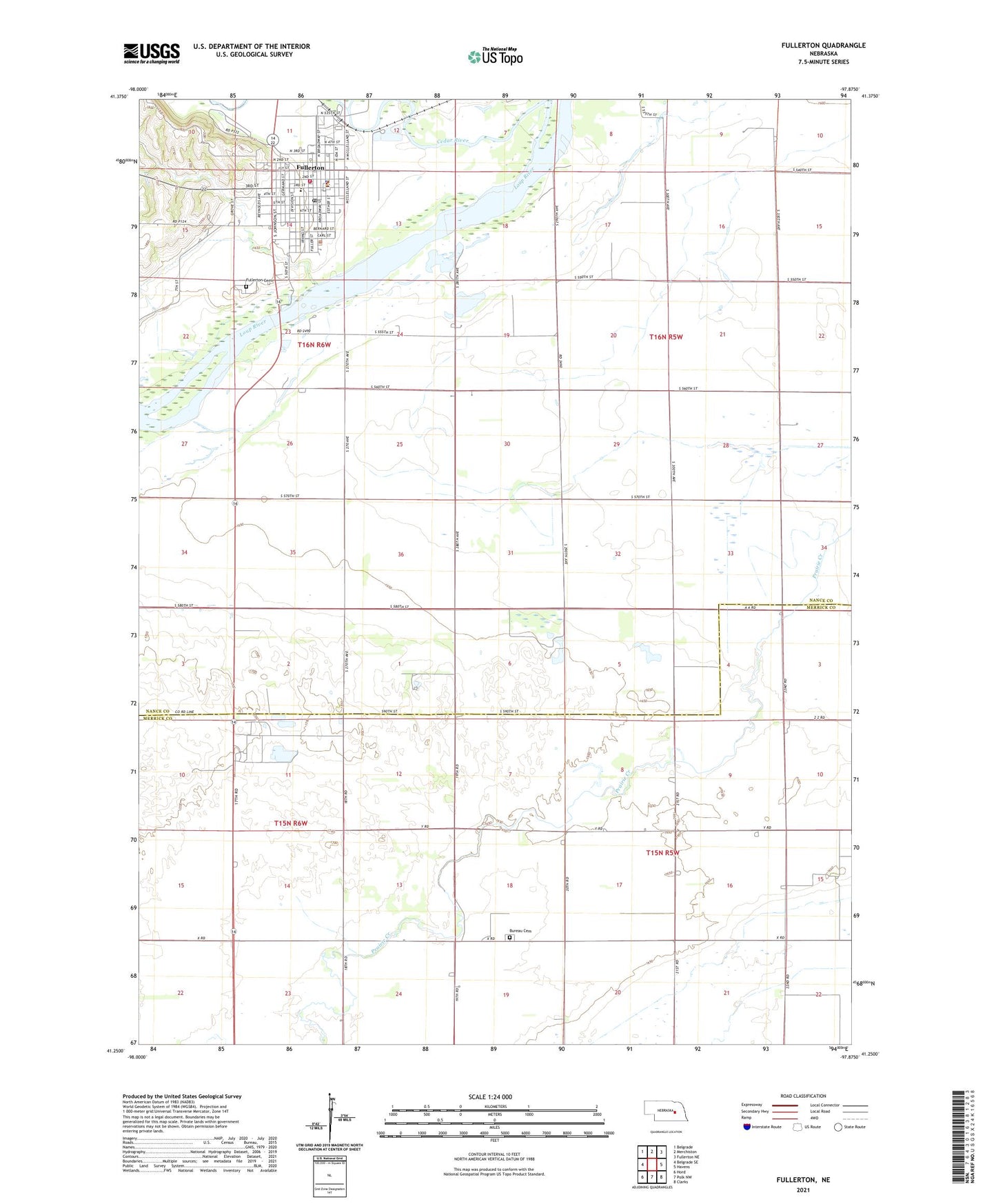
2021 topographic map quadrangle Fullerton in the state of Nebraska. Scale: 1:24000. Based on the newly updated USGS 7.5' US Topo map series, this map is in the following counties: Nance, Merrick. The map contains contour data, water features, and other items you are used to seeing on USGS maps, but also has updated roads and other features. This is the next generation of topographic maps. Printed on high-quality waterproof paper with UV fade-resistant inks.
Quads adjacent to this one:
West: Belgrade SE
Northwest: Belgrade
North: Merchiston
Northeast: Fullerton NE
East: Havens
Southeast: Clarks
South: Polk NW
Southwest: Hord
Contains the following named places: Bureau Cemetery, Cedar River, City of Fullerton, Elm Grove School, Fullerton, Fullerton Manor, Fullerton Park, Fullerton Post Office, Fullerton Public Library, Fullerton Public Schools, Fullerton Rescue Squad, Fullerton Vision Clinic, Fullerton Volunteer Fire Department, Kremer Public School, Lone Tree Medical Associates, Mormon Pioneer Campsite Historical Marker, Mount Calvary Lutheran Church, Nance County Courthouse, Nance County Medical Clinic, Nance County Sheriff's Office, Pierce Chapel, Pleasant Hill High School, Presbyterian Church, Red Top School, Saint Peters Catholic School, Saints Peter and Paul Catholic Church, School Number 25, Township of East Newman, Tri Valley Cooperative Elevator, United Methodist Church, Victory Baptist Church