MyTopo
Fullerton NE Nebraska US Topo Map
Couldn't load pickup availability
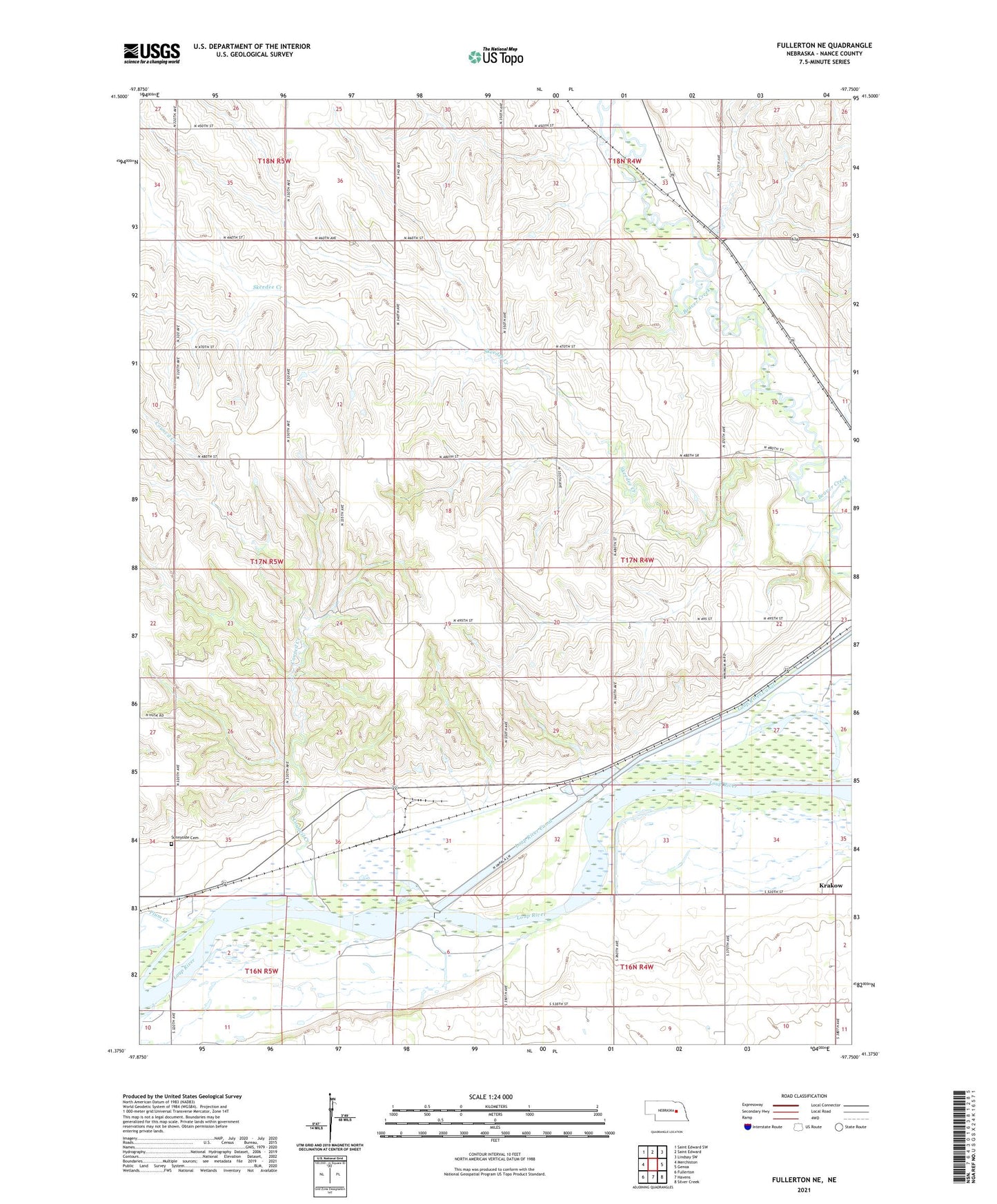
2021 topographic map quadrangle Fullerton NE in the state of Nebraska. Scale: 1:24000. Based on the newly updated USGS 7.5' US Topo map series, this map is in the following counties: Nance. The map contains contour data, water features, and other items you are used to seeing on USGS maps, but also has updated roads and other features. This is the next generation of topographic maps. Printed on high-quality waterproof paper with UV fade-resistant inks.
Quads adjacent to this one:
West: Merchiston
Northwest: Saint Edward SW
North: Saint Edward
Northeast: Lindsay SW
East: Genoa
Southeast: Silver Creek
South: Havens
Southwest: Fullerton
This map covers the same area as the classic USGS quad with code o41097d7.
Contains the following named places: Council Creek, Glendale School, Headworks Park, Kent, Krakow, Loup Diversion Dam, Loup Lands State Wildlife Management Area, Plainview School, Plum Creek, Sandy Road School, Shady Nook School, Skeedee Creek, Skeedee School, Skeedee View School, Sunnyside Cemetery, Sunnyside School, Township of Beaver, Township of Genoa, ZIP Code: 68640