MyTopo
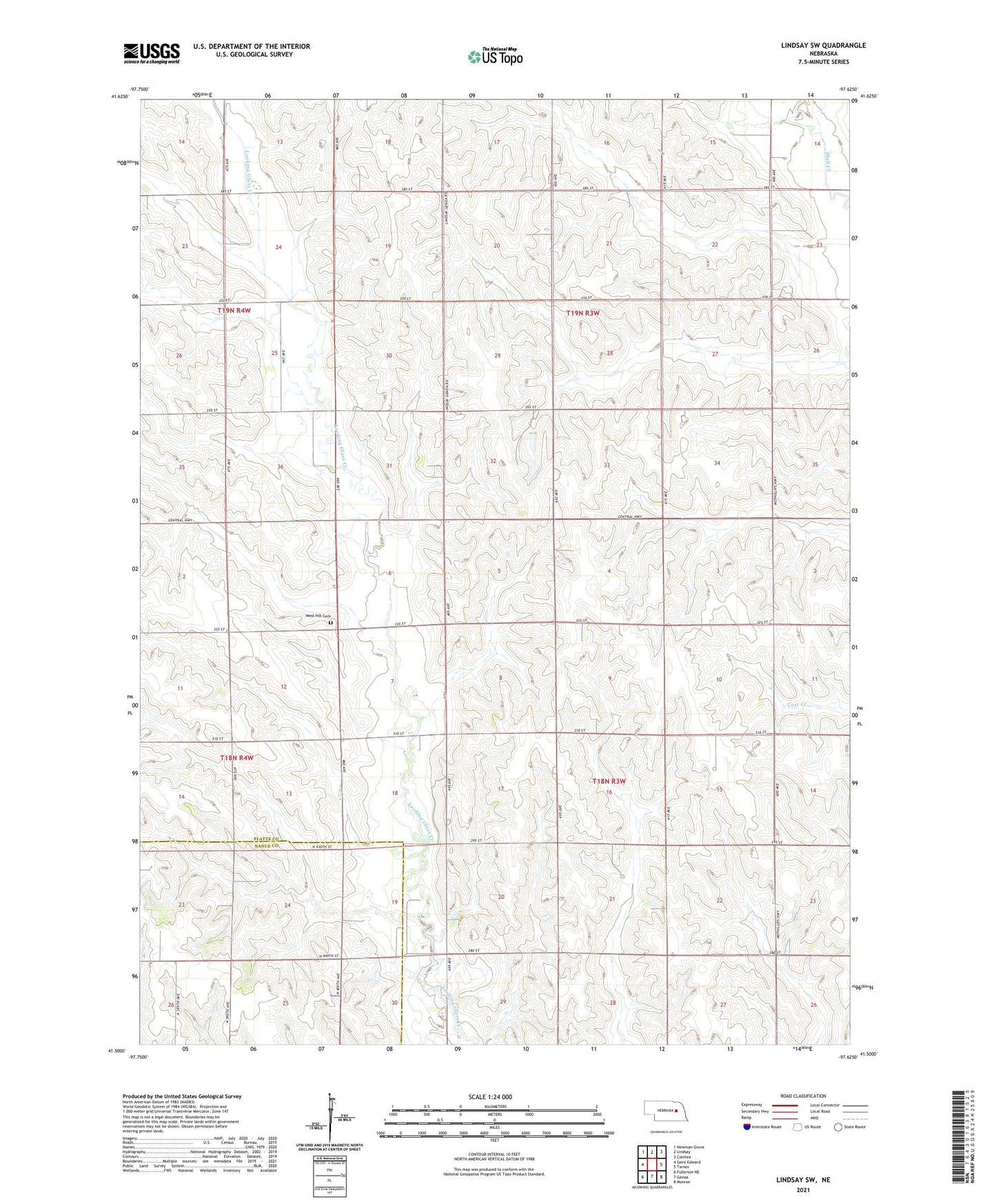
Lindsay SW Nebraska US Topo Map
Couldn't load pickup availability
2021 topographic map quadrangle Lindsay SW in the state of Nebraska. Scale: 1:24000. Based on the newly updated USGS 7.5' US Topo map series, this map is in the following counties: Platte, Nance. The map contains contour data, water features, and other items you are used to seeing on USGS maps, but also has updated roads and other features. This is the next generation of topographic maps. Printed on high-quality waterproof paper with UV fade-resistant inks.
Quads adjacent to this one:
West: Saint Edward
Northwest: Newman Grove
North: Lindsay
Northeast: Cornlea
East: Tarnov
Southeast: Monroe
South: Genoa
Southwest: Fullerton NE
This map covers the same area as the classic USGS quad with code o41097e6.
Contains the following named places: Bethany Church, KCAN-TV (Albion), KWMG-FM (Columbus), KZEN-FM (Central City), Okay Church, Okay School, Palestine Church, Postville Post Office, Postville School, Saint Pauls Church, School Number 26, School Number 39, Township of Joliet, Township of Monroe, West Hill Cemetery, West Hill Community Historical Marker, ZIP Code: 68647