MyTopo
Saint Edward Nebraska US Topo Map
Couldn't load pickup availability
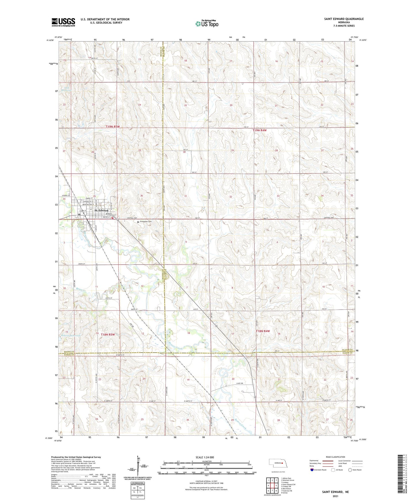
2021 topographic map quadrangle Saint Edward in the state of Nebraska. Scale: 1:24000. Based on the newly updated USGS 7.5' US Topo map series, this map is in the following counties: Platte, Boone, Nance. The map contains contour data, water features, and other items you are used to seeing on USGS maps, but also has updated roads and other features. This is the next generation of topographic maps. Printed on high-quality waterproof paper with UV fade-resistant inks.
Quads adjacent to this one:
West: Saint Edward SW
Northwest: Albion East
North: Newman Grove
Northeast: Lindsay
East: Lindsay SW
Southeast: Genoa
South: Fullerton NE
Southwest: Merchiston
This map covers the same area as the classic USGS quad with code o41097e7.
Contains the following named places: Big Cut School, Bogus Creek, City of Saint Edward, Cloverlodge Care Center, Elm School, Evergreen Cemetery, Faith Lutheran Church, J W Carters Grain Company Elevator, Kingdom Hall of Jehovahs Witnesses, Mount Pleasant School, Roberts Dam, Saint Edward, Saint Edward City Park, Saint Edward City Park Campground, Saint Edward Family Dentistry, Saint Edward Fire and Rescue Department, Saint Edward Historical Marker, Saint Edward Medical Clinic, Saint Edward Police Department, Saint Edward Post Office, Saint Edward Public Library, Saint Edward Public Schools, Saint Edwards Catholic Church, School Number 11, School Number 27, School Number 59, Township of Woodville, Tri Valley Cooperative Elevator, United Methodist Presbyterian Church, ZIP Code: 68660