MyTopo
Lyons Nebraska US Topo Map
Couldn't load pickup availability
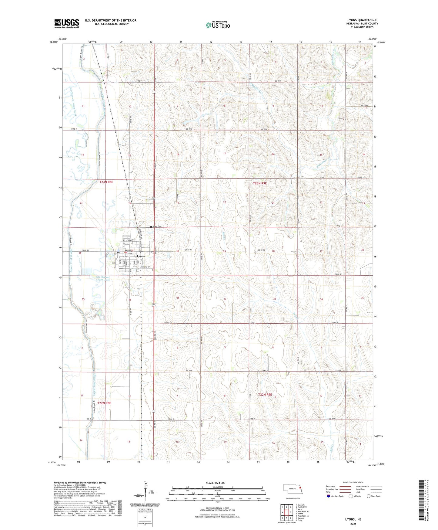
2021 topographic map quadrangle Lyons in the state of Nebraska. Scale: 1:24000. Based on the newly updated USGS 7.5' US Topo map series, this map is in the following counties: Burt. The map contains contour data, water features, and other items you are used to seeing on USGS maps, but also has updated roads and other features. This is the next generation of topographic maps. Printed on high-quality waterproof paper with UV fade-resistant inks.
Quads adjacent to this one:
West: West Point NE
Northwest: Bancroft
North: Walthill SW
Northeast: Macy
East: Bertha
Southeast: Craig
South: Oakland
Southwest: West Point SE
This map covers the same area as the classic USGS quad with code o41096h4.
Contains the following named places: Bethany Lutheran Church, Blackbird Church, City of Lyons, Community Care of Lyons, Holmquist Grain and Lumber Company Elevator, Island Park Campground, Jefferson School, Little Logan Creek, Lorensen Grain Company Incorporated Elevator, Lyons, Lyons Ballpark, Lyons Cemetery, Lyons City Park, Lyons Medical Clinic, Lyons Post Office, Lyons Public Library, Lyons Volunteer Fire and Rescue, Lyons-Decatur Northeast Schools, Memorial United Methodist Church, New Life Assembly of God Church, Presbyterian Church, Saint Johns Church, Saint Josephs Catholic Church, School Number 25, School Number 43, School Number 52, School Number 56, School Number 58, Township of Logan, ZIP Code: 68038