MyTopo
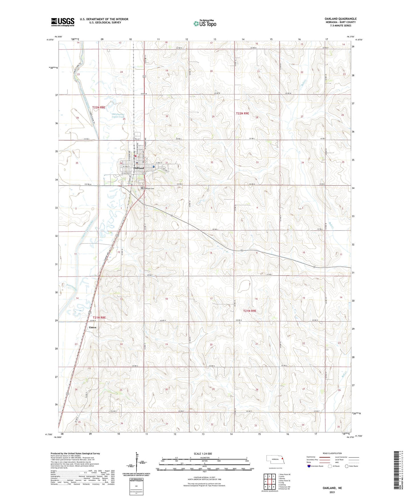
Oakland Nebraska US Topo Map
Couldn't load pickup availability
2021 topographic map quadrangle Oakland in the state of Nebraska. Scale: 1:24000. Based on the newly updated USGS 7.5' US Topo map series, this map is in the following counties: Burt. The map contains contour data, water features, and other items you are used to seeing on USGS maps, but also has updated roads and other features. This is the next generation of topographic maps. Printed on high-quality waterproof paper with UV fade-resistant inks.
Quads adjacent to this one:
West: West Point SE
Northwest: West Point NE
North: Lyons
Northeast: Bertha
East: Craig
Southeast: Nickerson NE
South: Nickerson NW
Southwest: Uehling
This map covers the same area as the classic USGS quad with code o41096g4.
Contains the following named places: Agland Co-op Elevator, Burt County Fairground, City of Oakland, Essen, Evangelical Free Church, Family Vision Center, First Baptist Church, First Evangelical Church, First United Methodist Church, Harmony School, Logan Creek Site Historical Marker, Mount Olive School, Oakland, Oakland City Park, Oakland City Park Campground, Oakland Craig Elementary School, Oakland Craig Senior High, Oakland Family Practice, Oakland Golf Club, Oakland Heights, Oakland Medical Clinic, Oakland Mercy Hospital, Oakland Post Office, Oakland Public Library, Oakland Volunteer Fire and Rescue, School Number 46, School Number 57, School Number 62, Swedish Heritage Center, Township of Bell Creek, Township of Craig, ZIP Codes: 68019, 68045