MyTopo
Genoa Nebraska US Topo Map
Couldn't load pickup availability
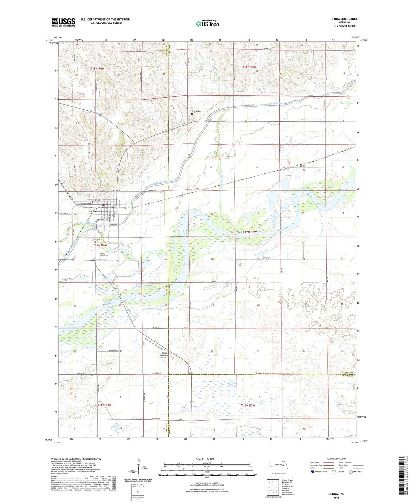
2021 topographic map quadrangle Genoa in the state of Nebraska. Scale: 1:24000. Based on the newly updated USGS 7.5' US Topo map series, this map is in the following counties: Platte, Nance, Merrick. The map contains contour data, water features, and other items you are used to seeing on USGS maps, but also has updated roads and other features. This is the next generation of topographic maps. Printed on high-quality waterproof paper with UV fade-resistant inks.
Quads adjacent to this one:
West: Fullerton NE
Northwest: Saint Edward
North: Lindsay SW
Northeast: Tarnov
East: Monroe
Southeast: Silver Creek SE
South: Silver Creek
Southwest: Havens
This map covers the same area as the classic USGS quad with code o41097d6.
Contains the following named places: Beaver Creek, City of Genoa, First Congregational United Church, Friends Cemetery, Genoa, Genoa City Park, Genoa City Park Campground, Genoa Community Hospital, Genoa Haven Home, Genoa Mormon Colony 1857-1859 Historical Marker, Genoa Municipal Airport, Genoa Post Office, Genoa Public Library, Genoa Public Schools, Genoa Railroad Station, Genoa Rescue Squad, Genoa Volunteer Fire Department, George Syas State Wildlife Management Area, Husker Co-op Elevator, Looking Glass Creek, Park Street Medical Clinic, Pawnee Historical Marker, Prairie Wolf State Wildlife Management Area, Saint Rose of Lima Catholic Church, School Number 13, School Number 34, School Number 6, Sunny Hollow School, Tri Valley Cooperative Elevator, United Methodist Church, Valley View Cemetery, Valley View School